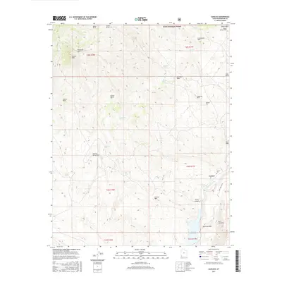
2017 Map of Gunlock
USGS Topo · Published 2017About this map
Gunlock sits at the eastern edge of this 2017 survey, positioned where the Santa Clara River flows toward the Gunlock Reservoir. The landscape is defined by the transition from the Dixie National Forest in the north to the northern reaches of the Mojave Desert in the west. This geography reveals a pattern of water-dependent landmarks, with numerous named springs and washes like Pahcoon Spring Wash and Grapevine Wash carving through the high desert terrain. Local history is anchored by the Gunlock Cem, while prominent geological features such as Jackson Peak, the Red Mountains, and the White Rocks provide orientation across the varied topography. The map illustrates a remote ranching and desert environment where survival and settlement have long been tied to the drainage systems of the Tobin Wash and Sand Cove Wash.
Find a feature on this map
36 named features on this map. Tap any name to fly to it.
Don’t see what you’re looking for? This feature index may not catch every label — zoom into the map to look around manually.
Map Details
Editions of this 2017 Gunlock Map
This is the sole edition of this map. No revisions or reprints were ever made.
Other maps of this area

1885 · St. George
USGS Topo · 1:250,000

1891 · St. George
USGS Topo · 1:250,000

1953 · Cedar City
USGS Topo · 1:250,000

1954 · Beaver Dam Mts NE
USGS Topo · 1:24,000

1954 · Gunlock
USGS Topo · 1:24,000

1954 · St. George
USGS Topo · 1:62,500

1956 · St. George NW
USGS Topo · 1:24,000

1958 · Cedar City
USGS Topo · 1:250,000

1962 · Cedar City
USGS Topo · 1:250,000
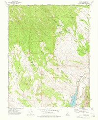
1972 · Gunlock
USGS Topo · 1:24,000