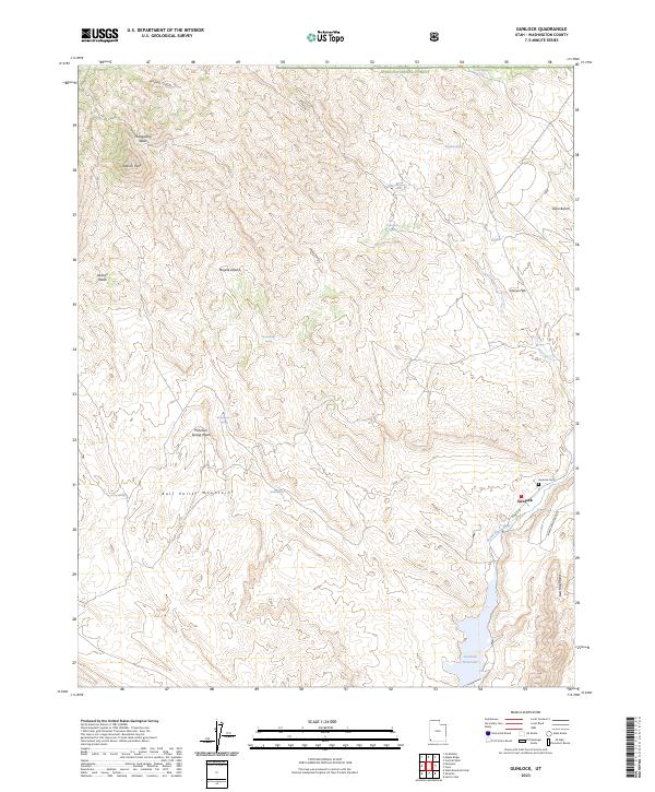
2023 Map of Gunlock
USGS Topo · Published 2023About this map
The settlement of Gunlock sits at a geographic crossroads where the Bull Valley Mountains meet the northern reaches of the Mojave Desert. This 2023 survey illustrates the modern layout of the town along the Santa Clara River, featuring the Gunlock Cem and residential infrastructure like N Main St. The landscape is defined by its water sources, from the prominent Gunlock Reservoir in the south to a network of upland springs including Eightmile Spring and Grapevine Spring.
Find a feature on this map
27 named features on this map. Tap any name to fly to it.
Don’t see what you’re looking for? This feature index may not catch every label — zoom into the map to look around manually.
Map Details
Editions of this 2023 Gunlock Map
This is the sole edition of this map. No revisions or reprints were ever made.
Other maps of this area

1885 · St. George
USGS Topo · 1:250,000

1891 · St. George
USGS Topo · 1:250,000

1953 · Cedar City
USGS Topo · 1:250,000

1954 · Beaver Dam Mts NE
USGS Topo · 1:24,000

1954 · Gunlock
USGS Topo · 1:24,000

1954 · St. George
USGS Topo · 1:62,500

1956 · St. George NW
USGS Topo · 1:24,000

1958 · Cedar City
USGS Topo · 1:250,000

1962 · Cedar City
USGS Topo · 1:250,000
1972 · Gunlock
USGS Topo · 1:24,000