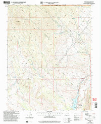
2002 Map of Gunlock
USGS Topo · Published 2005About this map
Gunlock sits at the convergence of high desert drainages and water management infrastructure in southern Utah. The settlement is positioned along the Santa Clara River just north of the Gunlock Reservoir, where the Gunlock State Park boundary meets the lower reaches of the Dixie National Forest. This 2002 revision shows a landscape shaped by both natural topography and resource extraction, with numerous prospects and prospect pits scattered across the eastern slopes above Miners Canyon.
Find a feature on this map
42 named features on this map. Tap any name to fly to it.
Don’t see what you’re looking for? This feature index may not catch every label — zoom into the map to look around manually.
Map Details
Editions of this 2002 Gunlock Map
This is the sole edition of this map. No revisions or reprints were ever made.
Other maps of this area

1885 · St. George
USGS Topo · 1:250,000

1891 · St. George
USGS Topo · 1:250,000

1953 · Cedar City
USGS Topo · 1:250,000

1954 · Beaver Dam Mts NE
USGS Topo · 1:24,000

1954 · Gunlock
USGS Topo · 1:24,000

1954 · St. George
USGS Topo · 1:62,500

1956 · St. George NW
USGS Topo · 1:24,000

1958 · Cedar City
USGS Topo · 1:250,000

1962 · Cedar City
USGS Topo · 1:250,000
1972 · Gunlock
USGS Topo · 1:24,000