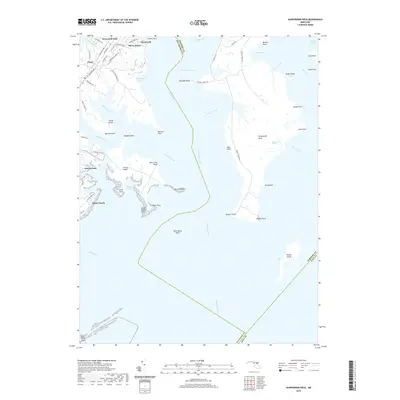
2019 Map of Gunpowder Neck
USGS Topo · Published 2019About this map
The Gunpowder River and Bush River define the intricate shoreline of this Harford County peninsula, where tidal estuaries and marshlands meet residential bayfront communities. Settlements such as Harewood Park, Oliver Beach, and Miami Beach line the western inlets, illustrating the suburban and recreational development patterns along the Chesapeake Bay. The expansive Gunpowder Neck dominates the central portion of the map, characterized by its deep finger-like points such as Rickett Point and Maxwell Point that reach into the surrounding waters.
Find a feature on this map
70 named features on this map. Tap any name to fly to it.
Don’t see what you’re looking for? This feature index may not catch every label — zoom into the map to look around manually.
Map Details
Editions of this 2019 Gunpowder Neck Map
This is the sole edition of this map. No revisions or reprints were ever made.
Other maps of this area

1893 · North Point
USGS Topo · 1:62,500

1893 · Gunpowder
USGS Topo · 1:62,500

1898 · Tolchester
USGS Topo · 1:125,000

1900 · Betterton
USGS Topo · 1:62,500

1901 · Chestertown
USGS Topo · 1:62,500

1901 · Gunpowder
USGS Topo · 1:62,500

1903 · Tolchester
USGS Topo · 1:125,000

1904 · North Point
USGS Topo · 1:62,500

1908 · Tolchester
USGS Topo · 1:125,000

1920 · Chestertown
USGS Topo · 1:62,500