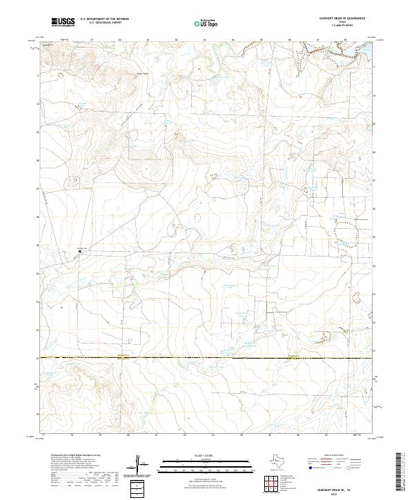
2022 Map of Gunsight Draw SE
USGS Topo · Published 2022About this map
The Borden Co and Howard Co border defines this West Texas landscape, where the upper reaches of the Colorado River and the western edge of Lake J B Thomas dominate the drainage system. This is ranching country, evidenced by the high density of named water catchments such as Bull Pasture Tank, Whitaker Field Tank, and the uniquely named Mother-in-Law Tank. The terrain is marked by prominent breaks and drainage features like Red Bluffs and Hackberry Draw, which channel seasonal water toward the larger river basin. Genealogy researchers will find Fairview Cem located near Ranch Rd 1785, a critical landmark for tracing family roots in this sparsely populated region. The map captures a traditional land-use pattern where localized water management, signified by Sand Rock Tank and Horseshoe Tank, supports agriculture across the varied elevations of Cedar Point.
Find a feature on this map
45 named features on this map. Tap any name to fly to it.
Don’t see what you’re looking for? This feature index may not catch every label — zoom into the map to look around manually.
Map Details
Editions of this 2022 Gunsight Draw SE Map
This is the sole edition of this map. No revisions or reprints were ever made.
Other maps of this area

1942 · Big Spring North
USGS Topo · 1:62,500

1951 · Ira SW
USGS Topo · 1:24,000

1951 · Ira NW
USGS Topo · 1:24,000

1951 · Vincent
USGS Topo · 1:24,000

1954 · Big Spring
USGS Topo · 1:250,000

1954 · Big Spring North NE
USGS Topo · 1:24,000

1958 · Big Spring
USGS Topo · 1:250,000

1970 · Mushaway Peak
USGS Topo · 1:24,000
1970 · Gunsight Draw
USGS Topo · 1:24,000
1970 · Gunsight Draw NE
USGS Topo · 1:24,000