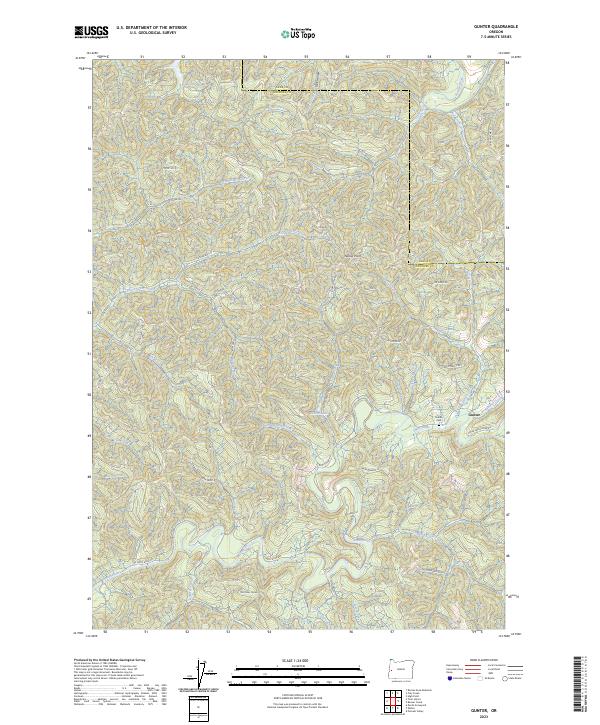
2023 Map of Gunter
USGS Topo · Published 2023About this map
Gunter stands as a focal point in this remote corner of Douglas County, where the Gunter Cem preserves the names of early residents. The landscape is defined by the complex drainage systems of the Siuslaw River and the Smith River, characterized by steep ridges and narrow hollows like Hell Hollow. The area's geography is heavily shaped by forestry and natural resource management, evident in the network of Bureau of Land Management roads such as BLM RD 20-7-7 and various spurs like Smith Quarry Sp.
Find a feature on this map
59 named features on this map. Tap any name to fly to it.
Don’t see what you’re looking for? This feature index may not catch every label — zoom into the map to look around manually.
Map Details
Editions of this 2023 Gunter Map
This is the sole edition of this map. No revisions or reprints were ever made.
Other maps of this area

1942 · Crow
USGS Topo · 1:62,500

1942 · Roman Nose Mtn
USGS Topo · 1:62,500

1945 · Crow
USGS Topo · 1:62,500

1945 · Roman Nose Mtn
USGS Topo · 1:62,500

1954 · Drain
USGS Topo · 1:62,500

1955 · Elkton
USGS Topo · 1:62,500

1958 · Roseburg
USGS Topo · 1:250,000

1959 · Roseburg
USGS Topo · 1:250,000

1979 · Cottage Grove
USGS Topo · 1:100,000
1984 · High Point
USGS Topo · 1:24,000