
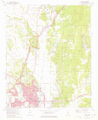
1973 Map of Guntown
USGS Topo · Published 1975About this map
Guntown and the surrounding Lee County countryside are documented here just as the modern Natchez Trace Parkway was being established through the eastern landscape. The area is defined by a dense network of country churches and family burial grounds, including Euclatubba Ch, St Thomas Aquinas Ch, and the Campbelltown Cem. This mid-1970s landscape shows the transition from traditional rail-dependent settlements like Baldwyn and Saltillo along the Illinois Central Gulf tracks to a more recreation-focused era, highlighted by Lake Lamar Bruce and the Five County Sportsman Lake. The terrain of Pea Ridge overlooks various creeks such as Euclatubba Creek and Mud Creek, while local industry is represented by scattered sandpits and rural feedlots.
Find a feature on this map
44 named features on this map. Tap any name to fly to it.
Don’t see what you’re looking for? This feature index may not catch every label — zoom into the map to look around manually.
Map Details
Editions of this 1973 Guntown Map
This is the sole edition of this map. No revisions or reprints were ever made.
Other maps of this area

1921 · Booneville
USGS Topo · 1:48,000

1921 · Tupelo
USGS Topo · 1:48,000

1922 · Booneville
USGS Topo · 1:62,500

1923 · Tupelo
USGS Topo · 1:62,500

1955 · Ripley
USGS Topo · 1:62,500

1955 · Sherman
USGS Topo · 1:62,500

1956 · Tupelo
USGS Topo · 1:250,000

1958 · Tupelo
USGS Topo · 1:250,000

1965 · Mooreville
USGS Topo · 1:24,000
1973 · Tupelo
USGS Topo · 1:24,000