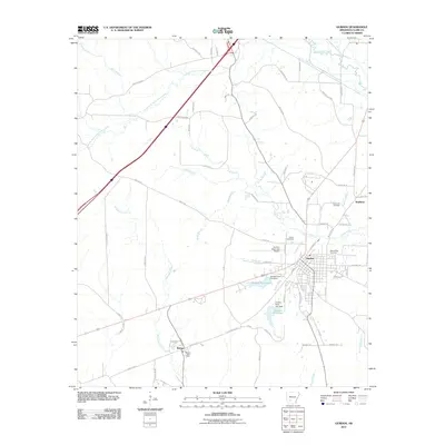
2011 Map of Gurdon
USGS Topo · Published 2011About this map
Gurdon serves as the primary hub of this Clark County landscape, where the confluence of rail and road infrastructure defines the local geography. To the southwest, the smaller settlement of Beirne is anchored by the Beirne Post Office, while Smithton marks the northeastern reaches of the area. The terrain is defined by a dense network of waterways, including Terre Noire Creek and Lick Creek, which drain toward the south. Local heritage is preserved in several dedicated spaces, such as Rose Hedge Cemetery, Greenville Cemetery, and Brown Cemetery. The industrial and utility history of the town is visible through landmarks like Gurdon Pond One and Gurdon Pond Two, both featuring named dams. Transportation corridors like the Old Gurdon Hwy and various rural routes, including Sticky Rd and Thornton Rd, weave through the timberlands and wetlands surrounding the town center.
Find a feature on this map
68 named features on this map. Tap any name to fly to it.
Don’t see what you’re looking for? This feature index may not catch every label — zoom into the map to look around manually.
Map Details
Editions of this 2011 Gurdon Map
This is the sole edition of this map. No revisions or reprints were ever made.
Other maps of this area

1901 · Gurdon
USGS Topo · 1:125,000

1943 · Antoine
USGS Topo · 1:62,500

1953 · El Dorado
USGS Topo · 1:250,000

1955 · Little Rock
USGS Topo · 1:250,000

1956 · Little Rock
USGS Topo · 1:250,000

1957 · El Dorado
USGS Topo · 1:250,000

1958 · El Dorado
USGS Topo · 1:250,000

1959 · Arkadelphia
USGS Topo · 1:24,000

1960 · El Dorado
USGS Topo · 1:250,000

1960 · Little Rock
USGS Topo · 1:250,000