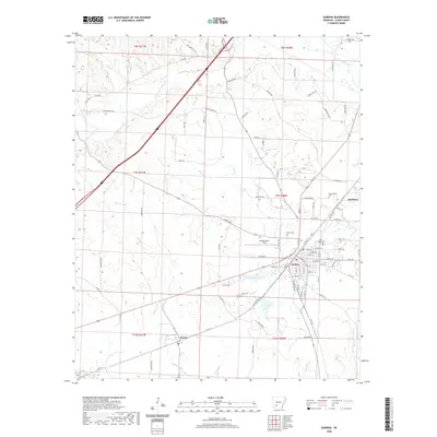
2020 Map of Gurdon
USGS Topo · Published 2020About this map
The timber and rail hub of Gurdon anchors this Clark County landscape, where the street grid of the town center meets the industrial activity at Gurdon Lowe Field. This 2020 survey reveals the geographic layout of a region defined by its waterway network, including the prominent Terre Noire Creek and its southern fork, alongside several smaller tributaries like Lick Creek and McNeeley Creek. The map provides specific locational data for researchers tracing local heritage, from the small outlying settlements of Beirne and Smithton to several established burial grounds such as Greenville Cemetery, Brown Cemetery, and Rose Hedge Cemetery. The combination of modern residential infrastructure and expansive wetlands like Gurdon Pond One illustrates the persistent relationship between the local economy and the lowland geography of southwestern Arkansas.
Find a feature on this map
107 named features on this map. Tap any name to fly to it.
Don’t see what you’re looking for? This feature index may not catch every label — zoom into the map to look around manually.
Map Details
Editions of this 2020 Gurdon Map
This is the sole edition of this map. No revisions or reprints were ever made.
Other maps of this area

1901 · Gurdon
USGS Topo · 1:125,000

1943 · Antoine
USGS Topo · 1:62,500

1953 · El Dorado
USGS Topo · 1:250,000

1955 · Little Rock
USGS Topo · 1:250,000

1956 · Little Rock
USGS Topo · 1:250,000

1957 · El Dorado
USGS Topo · 1:250,000

1958 · El Dorado
USGS Topo · 1:250,000

1959 · Arkadelphia
USGS Topo · 1:24,000

1960 · El Dorado
USGS Topo · 1:250,000

1960 · Little Rock
USGS Topo · 1:250,000