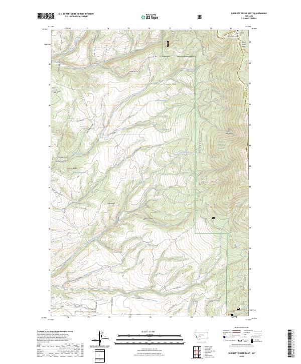
2024 Map of Gurnett Creek East
USGS Topo · Published 2024About this map
The Big Belt Mountains dominate this high-altitude landscape in the Helena National Forest, where the terrain is carved by a dense network of gulches and creeks. Named landmarks such as Hooligans Hill, Dutchie Butte, and Pilot Knob punctuate the ridges, while the presence of Hard Cash Spring and Mill Gulch suggests a history of localized prospecting and milling. The drainage pattern is complex, with the Middle Fork Duck Creek and Gurnett Creek flowing from the high divides, including the notable Duck Creek Pass on the boundary between Broadwater and Meagher counties.
Find a feature on this map
48 named features on this map. Tap any name to fly to it.
Don’t see what you’re looking for? This feature index may not catch every label — zoom into the map to look around manually.
Map Details
Editions of this 2024 Gurnett Creek East Map
This is the sole edition of this map. No revisions or reprints were ever made.
Other maps of this area

1886 · Fort Logan
USGS Topo · 1:250,000

1948 · White Sulphur Springs
USGS Topo · 1:250,000

1950 · Duck Creek Pass
USGS Topo · 1:62,500

1958 · White Sulphur Springs
USGS Topo · 1:250,000

1961 · White Sulphur Springs
USGS Topo · 1:250,000

1965 · White Sulphur Springs
USGS Topo · 1:250,000

1966 · Boulder Baldy
USGS Topo · 1:24,000

1966 · Diamond City
USGS Topo · 1:24,000
1971 · Mount Edith
USGS Topo · 1:24,000
1971 · Sulphur Bar Creek
USGS Topo · 1:24,000