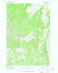
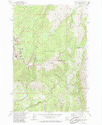
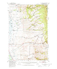
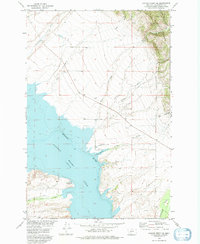
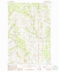
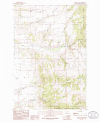
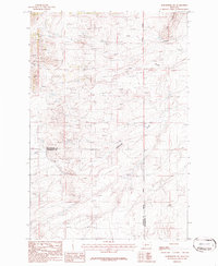
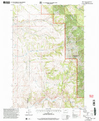
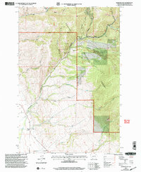
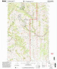
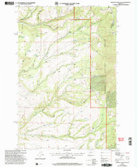
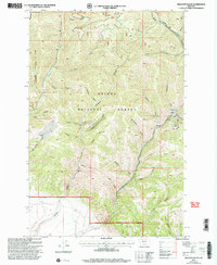
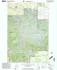
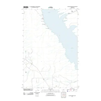
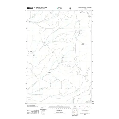
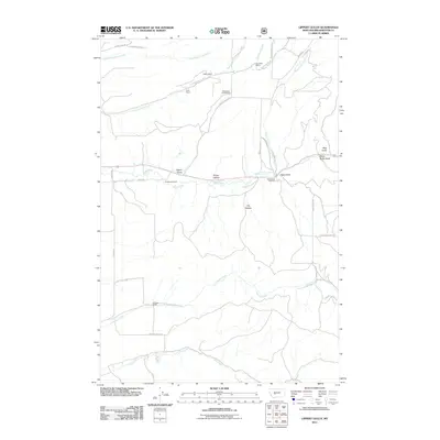
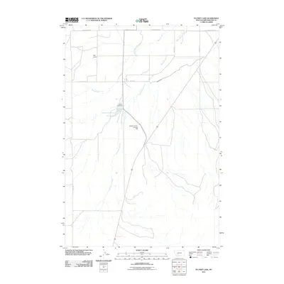
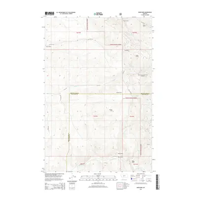
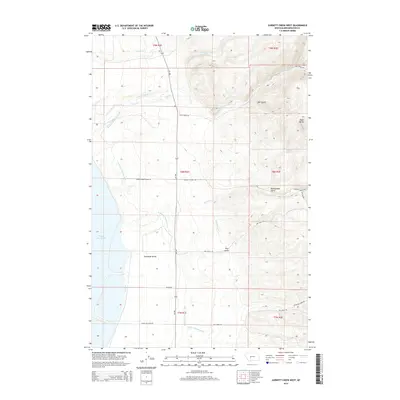
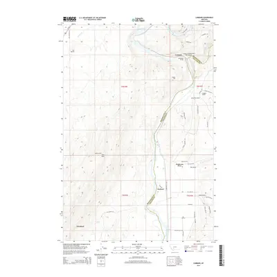
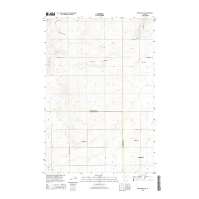
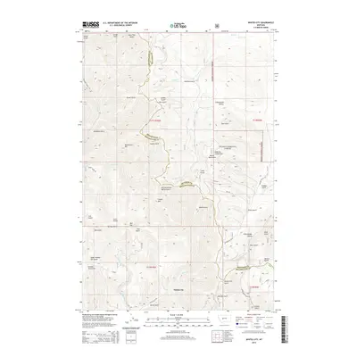
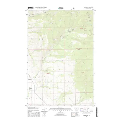
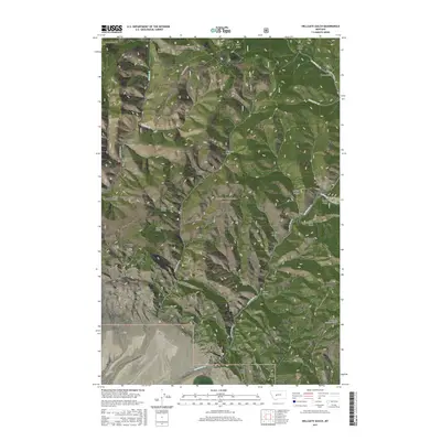
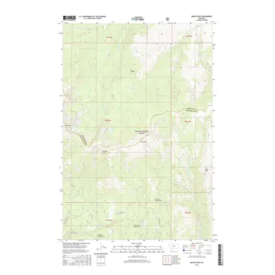
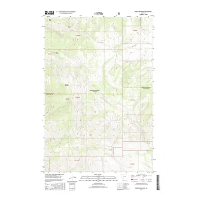
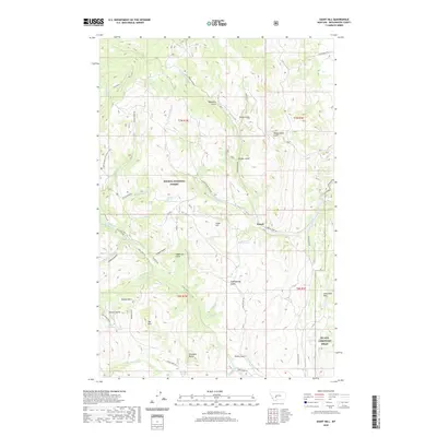
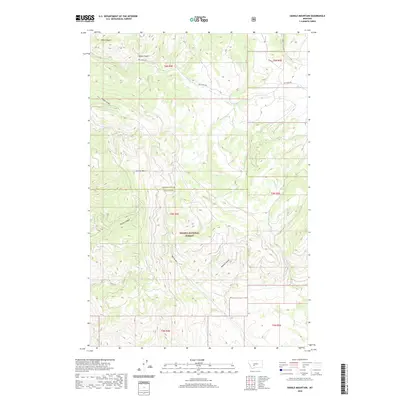
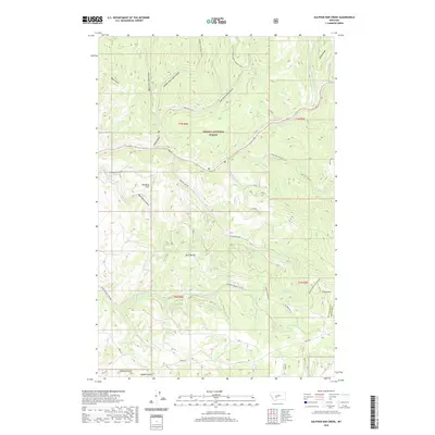
1971 Map of Mount Edith
USGS Topo · Published 1975About this map
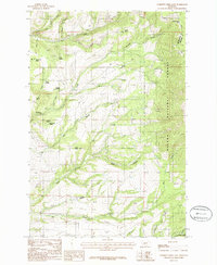
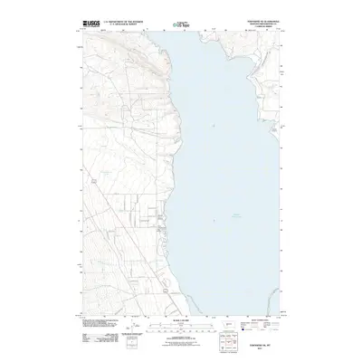
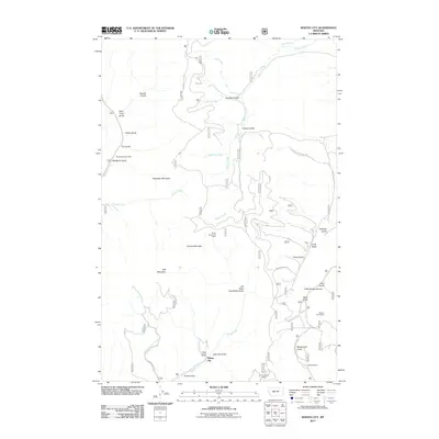
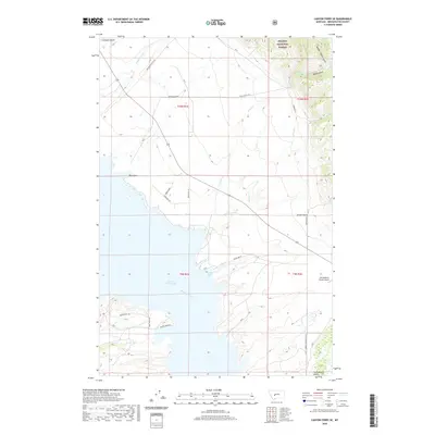
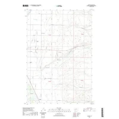
Mount Edith and the high peaks of the Big Belt Mountains dominate this section of the Helena National Forest along the border of Meagher and Broadwater counties. The landscape is defined by its drainage systems, with headwaters for Gipsy Creek, Birch Creek, and Ray Creek carving deep basins below ridges like Windy Ridge. High-elevation water bodies including Edith Lake, Hidden Lake, and Upper Baldy Lake sit in glacial cirques, providing focal points for the extensive network of pack trails and jeep trails shown throughout the forest. Several markings for Prospect and Prospects are found in the southern drainages near Holloway Gulch and East Fork Cabin Gulch, indicating the historical presence of mineral exploration in these remote gulches during the early 1970s.
Find a feature on this map
29 named features on this map. Tap any name to fly to it.
Don’t see what you’re looking for? This feature index may not catch every label — zoom into the map to look around manually.
Map Details
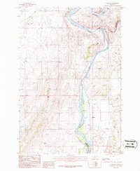
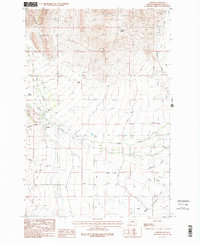
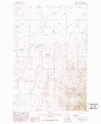
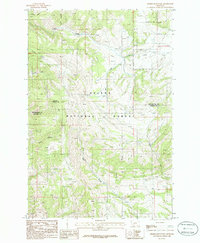
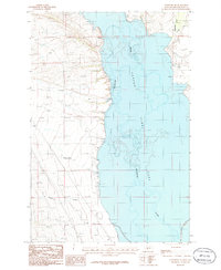
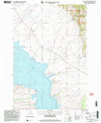
Editions of this 1971 Mount Edith Map
3 editions found
Historical Maps of Meagher County Through Time
129 maps found
1886 Fort Logan
Broadwater County, MT
1950 Canyon Ferry
Broadwater County, MT
1950 Duck Creek Pass
Broadwater County, MT
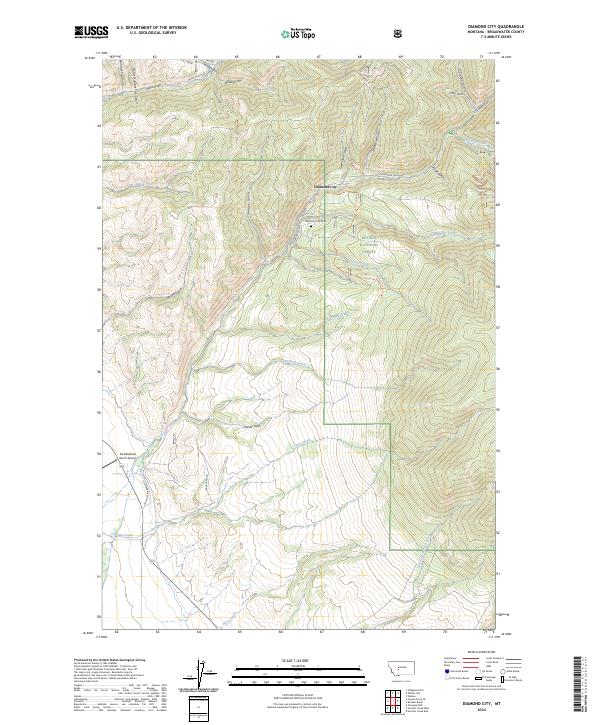
1966 Diamond City
Broadwater County, MT

1966 Whites City
Broadwater County, MT
1971 Mount Edith
Broadwater County, MT
1971 Sulphur Bar Creek
Broadwater County, MT
1972 Canyon Ferry SE
Broadwater County, MT
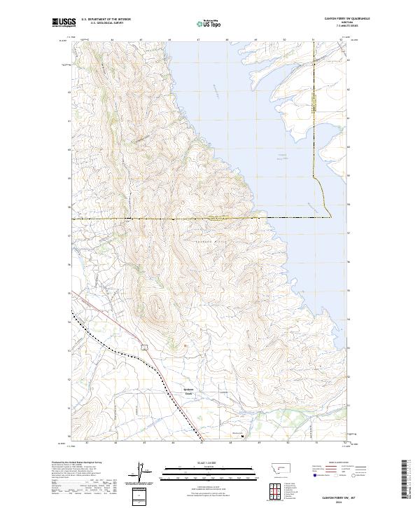
1972 Canyon Ferry SW
Broadwater County, MT
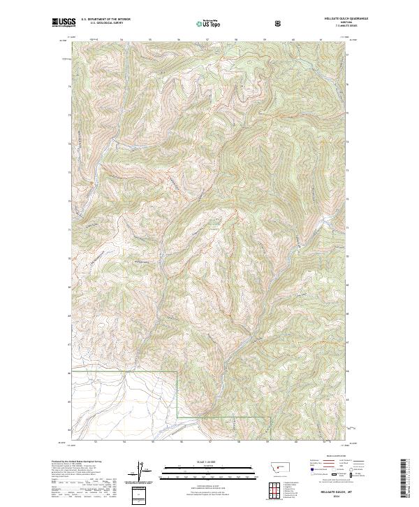
1972 Hellgate Gulch
Broadwater County, MT
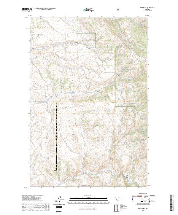
1986 Deer Park
Broadwater County, MT
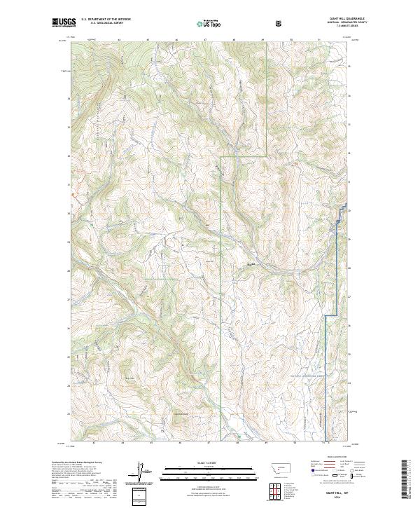
1986 Giant Hill
Broadwater County, MT
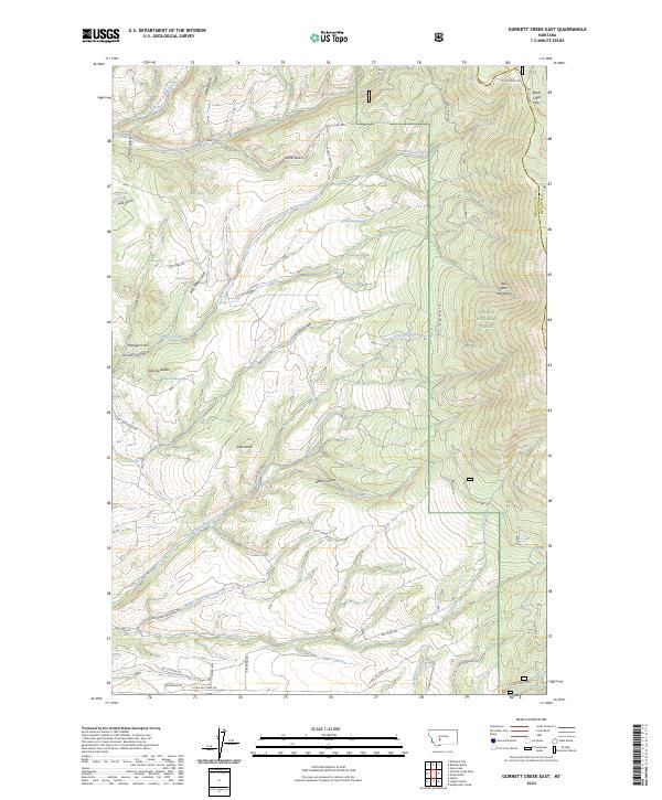
1986 Gurnett Creek East
Broadwater County, MT
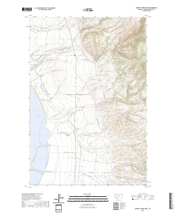
1986 Gurnett Creek West
Broadwater County, MT
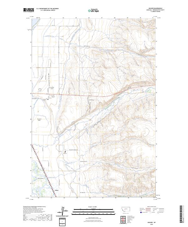
1986 Holker
Broadwater County, MT
1986 Lippert Gulch
Broadwater County, MT
1986 Lombard
Broadwater County, MT
1986 Parker
Broadwater County, MT
1986 Plunket Lake
Broadwater County, MT
1986 Radersburg SW
Broadwater County, MT
1986 Sixmile Mountain
Broadwater County, MT
1986 Townsend NE
Broadwater County, MT
2001 Canyon Ferry SE
Broadwater County, MT
2001 Deer Park
Broadwater County, MT
2001 Diamond City
Broadwater County, MT
2001 Giant Hill
Broadwater County, MT
2001 Gurnett Creek East
Broadwater County, MT
2001 Hellgate Gulch
Broadwater County, MT
2001 Holker
Broadwater County, MT
2001 Lippert Gulch
Broadwater County, MT
2001 Mount Edith
Broadwater County, MT
2001 Sixmile Mountain
Broadwater County, MT
2001 Sulphur Bar Creek
Broadwater County, MT
2001 Whites City
Broadwater County, MT
2011 Canyon Ferry SE
Broadwater County, MT
2011 Canyon Ferry SW
Broadwater County, MT
2011 Deer Park
Broadwater County, MT
2011 Diamond City
Broadwater County, MT
2011 Giant Hill
Broadwater County, MT
2011 Gurnett Creek East
Broadwater County, MT
2011 Gurnett Creek West
Broadwater County, MT
2011 Hellgate Gulch
Broadwater County, MT
2011 Holker
Broadwater County, MT
2011 Lippert Gulch
Broadwater County, MT
2011 Lombard
Broadwater County, MT
2011 Mount Edith
Broadwater County, MT
2011 Parker
Broadwater County, MT
2011 Plunket Lake
Broadwater County, MT
2011 Radersburg SW
Broadwater County, MT
2011 Sixmile Mountain
Broadwater County, MT
2011 Sulphur Bar Creek
Broadwater County, MT
2011 Townsend NE
Broadwater County, MT
2011 Whites City
Broadwater County, MT
2014 Canyon Ferry SE
Broadwater County, MT
2014 Canyon Ferry SW
Broadwater County, MT
2014 Deer Park
Broadwater County, MT
2014 Diamond City
Broadwater County, MT
2014 Giant Hill
Broadwater County, MT
2014 Gurnett Creek East
Broadwater County, MT
2014 Gurnett Creek West
Broadwater County, MT
2014 Hellgate Gulch
Broadwater County, MT
2014 Holker
Broadwater County, MT
2014 Lippert Gulch
Broadwater County, MT
2014 Lombard
Broadwater County, MT
2014 Mount Edith
Broadwater County, MT
2014 Parker
Broadwater County, MT
2014 Plunket Lake
Broadwater County, MT
2014 Radersburg SW
Broadwater County, MT
2014 Sixmile Mountain
Broadwater County, MT
2014 Sulphur Bar Creek
Broadwater County, MT
2014 Townsend NE
Broadwater County, MT
2014 Whites City
Broadwater County, MT
2017 Canyon Ferry SE
Broadwater County, MT
2017 Canyon Ferry SW
Broadwater County, MT
2017 Deer Park
Broadwater County, MT
2017 Diamond City
Broadwater County, MT
2017 Giant Hill
Broadwater County, MT
2017 Gurnett Creek East
Broadwater County, MT
2017 Gurnett Creek West
Broadwater County, MT
2017 Hellgate Gulch
Broadwater County, MT
2017 Holker
Broadwater County, MT
2017 Lippert Gulch
Broadwater County, MT
2017 Lombard
Broadwater County, MT
2017 Mount Edith
Broadwater County, MT
2017 Parker
Broadwater County, MT
2017 Plunket Lake
Broadwater County, MT
2017 Radersburg SW
Broadwater County, MT
2017 Sixmile Mountain
Broadwater County, MT
2017 Sulphur Bar Creek
Broadwater County, MT
2017 Townsend NE
Broadwater County, MT
2017 Whites City
Broadwater County, MT
2020 Canyon Ferry SE
Broadwater County, MT
2020 Canyon Ferry SW
Broadwater County, MT
2020 Deer Park
Broadwater County, MT
2020 Diamond City
Broadwater County, MT
2020 Giant Hill
Broadwater County, MT
2020 Gurnett Creek East
Broadwater County, MT
2020 Gurnett Creek West
Broadwater County, MT
2020 Hellgate Gulch
Broadwater County, MT
2020 Holker
Broadwater County, MT
2020 Lippert Gulch
Broadwater County, MT
2020 Lombard
Broadwater County, MT
2020 Mount Edith
Broadwater County, MT
2020 Parker
Broadwater County, MT
2020 Plunket Lake
Broadwater County, MT
2020 Radersburg SW
Broadwater County, MT
2020 Sixmile Mountain
Broadwater County, MT
2020 Sulphur Bar Creek
Broadwater County, MT
2020 Townsend NE
Broadwater County, MT
2020 Whites City
Broadwater County, MT
2024 Canyon Ferry SE
Broadwater County, MT
2024 Canyon Ferry SW
Broadwater County, MT
2024 Deer Park
Broadwater County, MT
2024 Diamond City
Broadwater County, MT
2024 Giant Hill
Broadwater County, MT
2024 Gurnett Creek East
Broadwater County, MT
2024 Gurnett Creek West
Broadwater County, MT
2024 Hellgate Gulch
Broadwater County, MT
2024 Holker
Broadwater County, MT
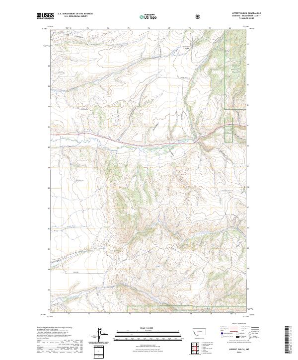
2024 Lippert Gulch
Broadwater County, MT
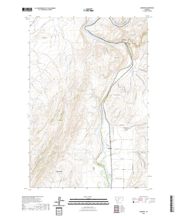
2024 Lombard
Broadwater County, MT
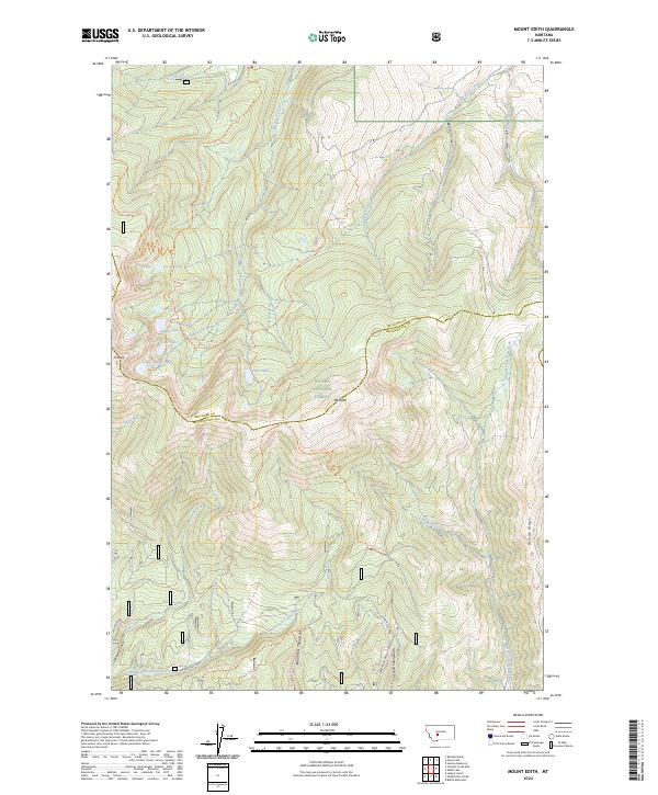
2024 Mount Edith
Broadwater County, MT
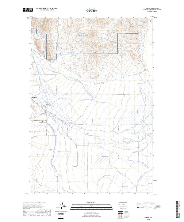
2024 Parker
Broadwater County, MT
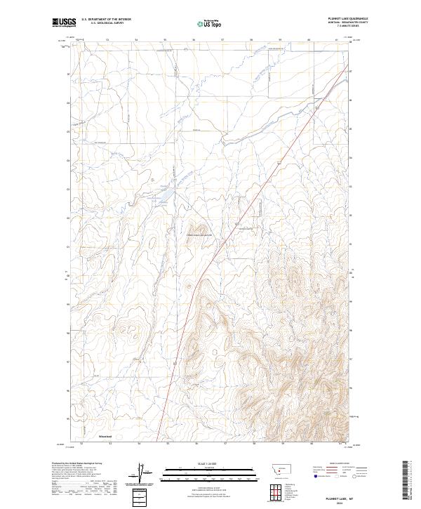
2024 Plunket Lake
Broadwater County, MT
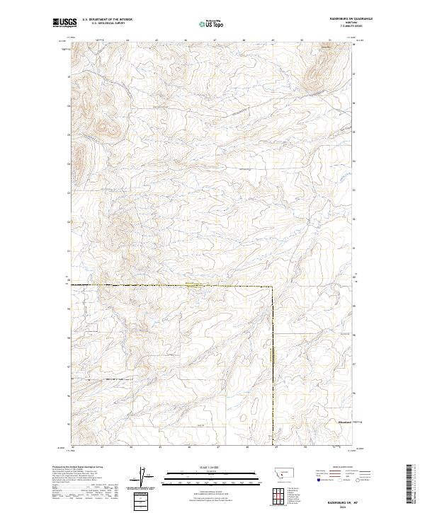
2024 Radersburg SW
Broadwater County, MT
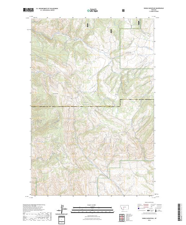
2024 Sixmile Mountain
Broadwater County, MT
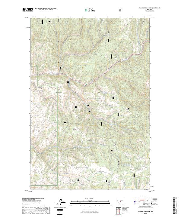
2024 Sulphur Bar Creek
Broadwater County, MT
2024 Townsend NE
Broadwater County, MT
2024 Whites City
Broadwater County, MT