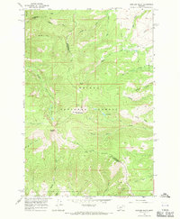
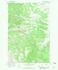
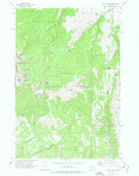
1966 Map of Boulder Baldy
USGS Topo · Published 1970About this map
The Helena National Forest dominates this mid-1960s survey, capturing a high-elevation Montana landscape at the boundary of Meagher and Broadwater counties. The terrain is defined by the prominent peak of Boulder Baldy and the adjacent Boulder Mountain, where the headwaters of numerous drainages begin their descent. This area serves as a significant watershed, feeding several branches of Camas Creek and the Middle Fork Duck Creek.
Find a feature on this map
30 named features on this map. Tap any name to fly to it.
Don’t see what you’re looking for? This feature index may not catch every label — zoom into the map to look around manually.
Map Details
Editions of this 1966 Boulder Baldy Map
3 editions found

Other maps of this area

1886 · Fort Logan
USGS Topo · 1:250,000

1948 · White Sulphur Springs
USGS Topo · 1:250,000
1950 · Duck Creek Pass
USGS Topo · 1:62,500

1958 · White Sulphur Springs
USGS Topo · 1:250,000

1961 · White Sulphur Springs
USGS Topo · 1:250,000

1965 · White Sulphur Springs
USGS Topo · 1:250,000
1966 · Diamond City
USGS Topo · 1:24,000
1966 · Whites City
USGS Topo · 1:24,000

1966 · Watson
USGS Topo · 1:24,000
1971 · Mount Edith
USGS Topo · 1:24,000