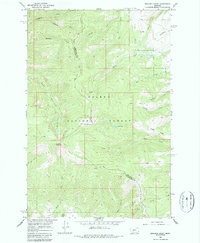
1966 Map of Boulder Baldy
USGS Topo · Published 1987About this map
Boulder Baldy and Boulder Mountain anchor this high-altitude landscape within the Helena National Forest, where the county line between Meagher and Broadwater counties follows the primary mountain divide. The 1966 field check reveals a network of primitive transportation routes, including the Confederate Trail, various unnamed Pack Trails, and Jeep Trails that skirt the drainages of Elk Creek and Duck Creek. These trails provide the only access to remote alpine features such as Boulder Lakes and Camas Lake. Historical land use is hinted at by a single Prospect located near Camas Ridge, while the naming of Irish Gulch and Debauch Gulch reflects the colorful legacy of early western surveyors and miners who moved through these steep Montana corridors.
Find a feature on this map
28 named features on this map. Tap any name to fly to it.
Don’t see what you’re looking for? This feature index may not catch every label — zoom into the map to look around manually.
Map Details
Editions of this 1966 Boulder Baldy Map
3 editions found
Other maps of this area

1886 · Fort Logan
USGS Topo · 1:250,000

1948 · White Sulphur Springs
USGS Topo · 1:250,000

1950 · Duck Creek Pass
USGS Topo · 1:62,500

1958 · White Sulphur Springs
USGS Topo · 1:250,000

1961 · White Sulphur Springs
USGS Topo · 1:250,000

1965 · White Sulphur Springs
USGS Topo · 1:250,000

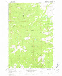
1966 · Boulder Baldy
USGS Topo · 1:24,000

1966 · Diamond City
USGS Topo · 1:24,000

1966 · Whites City
USGS Topo · 1:24,000

1966 · Watson
USGS Topo · 1:24,000