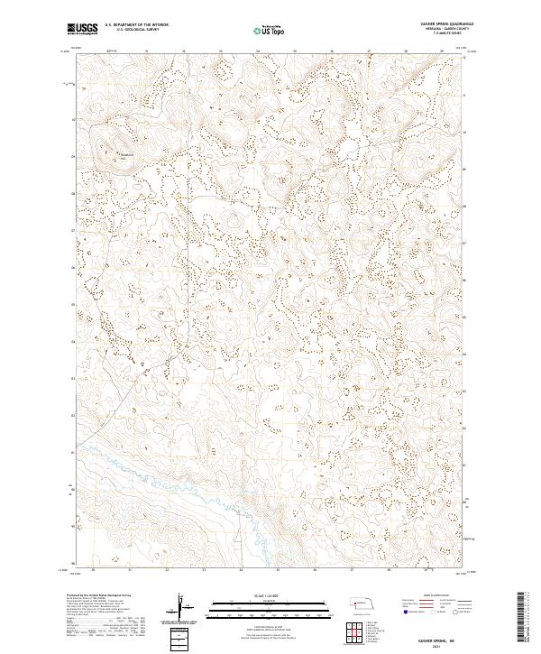
2021 Map of Gusher Spring
USGS Topo · Published 2021About this map
Blue Creek meanders across this corner of Garden County, Nebraska, where the Sandhills landscape is punctuated by the notable Gusher Spring. This 2021 survey reveals a quiet ranching country defined by section lines and local transit routes such as RD 82 and RD 193. The terrain is characterized by the elevation of Wildhorse Hill, providing a distinct landmark in an area otherwise dominated by the systematic grid of the Public Land Survey System, including townships t19n r43w and t18n r42w. The hydrology of the region is centered on the creek's drainage, which serves as a vital water source for the surrounding prairie.
Find a feature on this map
9 named features on this map. Tap any name to fly to it.
Don’t see what you’re looking for? This feature index may not catch every label — zoom into the map to look around manually.
Map Details
Editions of this 2021 Gusher Spring Map
This is the sole edition of this map. No revisions or reprints were ever made.
Other maps of this area

1900 · Chappell
USGS Topo · 1:125,000

1949 · Rackett
USGS Topo · 1:62,500

1950 · Crescent Lake
USGS Topo · 1:62,500

1951 · Rackett
USGS Topo · 1:62,500

1954 · Scottsbluff
USGS Topo · 1:250,000

1958 · Scottsbluff
USGS Topo · 1:250,000
1971 · Twin Buttes
USGS Topo · 1:24,000
1971 · Old Baldy
USGS Topo · 1:24,000
1971 · Oshkosh
USGS Topo · 1:24,000
1985 · Chappell
USGS Topo · 1:100,000