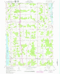
1961 Map of Gustavus
USGS Topo · Published 1980About this map
The agricultural townships of Gustavus, Greene, Johnston, and Mecca are depicted here during a period of transition as the landscape adapted to regional water management and recreational development. A significant portion of the western boundary is dominated by the Mosquito Creek drainage, encompassing both the Mosquito Creek Wildlife Area and Mosquito Creek State Park. These conservation zones contrast with the rigid grid of rural roads, such as York Street and Mahan Denman Road, which connect longstanding local centers like Triumph, Kenilworth, and Johnston.
Find a feature on this map
45 named features on this map. Tap any name to fly to it.
Don’t see what you’re looking for? This feature index may not catch every label — zoom into the map to look around manually.
Map Details
Editions of this 1961 Gustavus Map
3 editions found
Other maps of this area

1905 · Andover
USGS Topo · 1:48,000

1905 · Bristolville
USGS Topo · 1:62,500

1905 · Jefferson
USGS Topo · 1:62,500

1907 · Andover
USGS Topo · 1:62,500

1907 · Kinsman
USGS Topo · 1:62,500

1907 · Bristolville
USGS Topo · 1:62,500

1907 · Jefferson
USGS Topo · 1:62,500

1950 · Cleveland
USGS Topo · 1:250,000

1956 · Cleveland
USGS Topo · 1:250,000
1959 · Andover
USGS Topo · 1:24,000
Featured Places
- Mecca Township, OH
- Mecca, Mecca Township
- Johnston, Johnston Township
- Johnston Township, OH
- Gustavus Township, OH