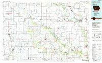
1984 Map of Guthrie Center
USGS Topo · Published 1985About this map
The Middle Raccoon River and North Raccoon River define the agricultural landscape of west-central Iowa during the mid-1980s. This planimetric survey captures the region's managed wilderness and recreational spaces, from Springbrook State Park to specialized conservation zones like the Dunbar Slough Wildlife Management Area and Lenon Mill State Wildlife Management Area. These protected lands are interspersed with traditional farming communities and county seats connected by the Chicago and North Western rail line.
Find a feature on this map
88 named features on this map. Tap any name to fly to it.
Don’t see what you’re looking for? This feature index may not catch every label — zoom into the map to look around manually.
Map Details
Editions of this 1984 Guthrie Center Map
This is the sole edition of this map. No revisions or reprints were ever made.
Other maps of this area

1908 · Waukee
USGS Topo · 1:62,500

1911 · Madrid
USGS Topo · 1:62,500

1914 · Madrid
USGS Topo · 1:62,500

1916 · Boone
USGS Topo · 1:62,500

1949 · Adel
USGS Topo · 1:62,500

1950 · Perry
USGS Topo · 1:62,500

1951 · Perry
USGS Topo · 1:62,500

1951 · Ogden
USGS Topo · 1:62,500

1951 · Adel
USGS Topo · 1:62,500

1951 · St. Charles
USGS Topo · 1:62,500