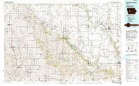
1993 Map of Guthrie Center
USGS Topo · Published 1993About this map
The Middle Raccoon River and South Raccoon River carve a significant path through this western Iowa landscape, anchoring a network of small towns and conserved lands. The map details the region as it appeared in the early 1990s, highlighting the Chicago and North Western RR corridor passing through communities like Coon Rapids, Bayard, and Perry. Rural infrastructure is well-documented, featuring landmarks such as the County Mem Hosp and the Violet Hill Cem near Perry, alongside more industrial elements like the Gas Storage Area near Redfield.
Find a feature on this map
123 named features on this map. Tap any name to fly to it.
Don’t see what you’re looking for? This feature index may not catch every label — zoom into the map to look around manually.
Map Details
Editions of this 1993 Guthrie Center Map
This is the sole edition of this map. No revisions or reprints were ever made.
Other maps of this area

1908 · Waukee
USGS Topo · 1:62,500

1911 · Madrid
USGS Topo · 1:62,500

1914 · Madrid
USGS Topo · 1:62,500

1916 · Boone
USGS Topo · 1:62,500

1949 · Adel
USGS Topo · 1:62,500

1950 · Perry
USGS Topo · 1:62,500

1951 · Perry
USGS Topo · 1:62,500

1951 · Ogden
USGS Topo · 1:62,500

1951 · Adel
USGS Topo · 1:62,500

1951 · St. Charles
USGS Topo · 1:62,500