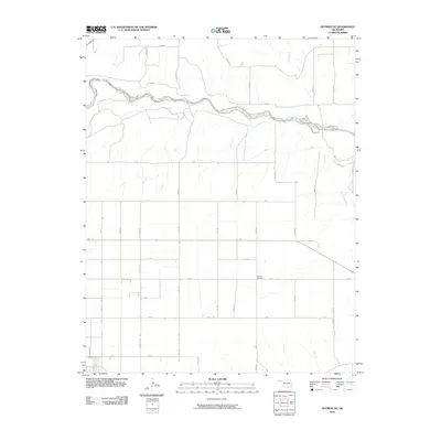
2010 Map of Guymon NE
USGS Topo · Published 2010About this map
The Beaver River snakes across the northern reaches of this High Plains landscape, its braided channel defining the hydrology of the Oklahoma Panhandle. North of the river, Pony Creek feeds into the basin, while the surrounding tableland is organized by a rigid grid of section-line roads such as Fast Rd and Mile 37. This geometric arrangement of the land reflects the enduring legacy of the Public Land Survey System in Texas County, where agricultural parcels are clearly delineated for miles. Centrally located within this rural network is the Banner Cemetery, a significant landmark for those tracing local family histories and early settlement patterns. The map highlights the intersection of natural riverine features with the modern, structured road systems like Mile 40 and Rd X that facilitate movement across this expansive prairie.
Find a feature on this map
33 named features on this map. Tap any name to fly to it.
Don’t see what you’re looking for? This feature index may not catch every label — zoom into the map to look around manually.
Map Details
Editions of this 2010 Guymon NE Map
This is the sole edition of this map. No revisions or reprints were ever made.
Other maps of this area

1954 · Perryton
USGS Topo · 1:250,000

1958 · Perryton
USGS Topo · 1:250,000

1967 · Straight SW
USGS Topo · 1:24,000

1967 · Optima
USGS Topo · 1:24,000

1967 · Hooker
USGS Topo · 1:24,000

1968 · Hardesty
USGS Topo · 1:24,000

1968 · Optima Dam
USGS Topo · 1:24,000

1968 · Guymon
USGS Topo · 1:24,000

1968 · Guymon SW
USGS Topo · 1:24,000

1968 · Guymon NE
USGS Topo · 1:24,000