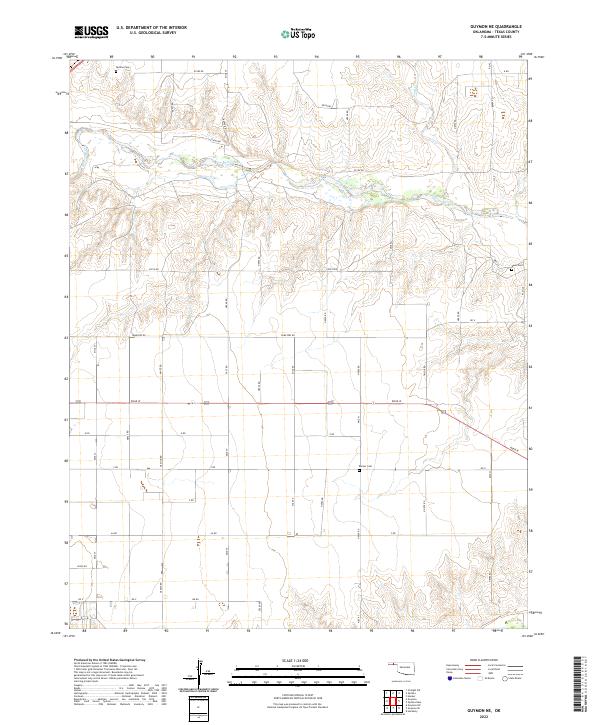
2022 Map of Guymon NE
USGS Topo · Published 2022About this map
The Beaver River and its tributary Pony Cr define the northern terrain of this Panhandle landscape in Texas County. This modern survey illustrates the expansive grid of rural routes that facilitate movement through the agricultural high plains, including Cemetery Rd, White Rd, and Road W. For those tracing local heritage, the map identifies three distinct burial grounds: Optima Cem in the northwest, Banner Cem near the central southern border, and Keen Cem to the east. The layout of these sites and the named farm-to-market roads like Fast Rd and Mile 39 provide a clear view of the organized settlement patterns and land management that persist in this part of Oklahoma today.
Find a feature on this map
49 named features on this map. Tap any name to fly to it.
Don’t see what you’re looking for? This feature index may not catch every label — zoom into the map to look around manually.
Map Details
Editions of this 2022 Guymon NE Map
This is the sole edition of this map. No revisions or reprints were ever made.
Other maps of this area

1954 · Perryton
USGS Topo · 1:250,000

1958 · Perryton
USGS Topo · 1:250,000

1967 · Straight SW
USGS Topo · 1:24,000

1967 · Optima
USGS Topo · 1:24,000

1967 · Hooker
USGS Topo · 1:24,000

1968 · Hardesty
USGS Topo · 1:24,000

1968 · Optima Dam
USGS Topo · 1:24,000

1968 · Guymon
USGS Topo · 1:24,000

1968 · Guymon SW
USGS Topo · 1:24,000

1968 · Guymon NE
USGS Topo · 1:24,000