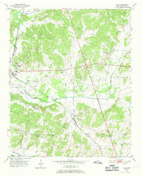
1951 Map of Guys
USGS Topo · Published 1969About this map
McNairy County's agricultural and rural school landscape is documented here in the early 1950s, centered on the Guys settlement. This area is characterized by a dense network of country schools, including the Rosenwald Sch, reflecting the era's segregated educational infrastructure, alongside Adams Chapel Sch and St Rest Sch. These institutions, paired with numerous small churches like Wades Chapel and Olive Hill Ch, formed the social anchors of the hilly terrain between Oxford and Gravel Hill.
Find a feature on this map
35 named features on this map. Tap any name to fly to it.
Don’t see what you’re looking for? This feature index may not catch every label — zoom into the map to look around manually.
Map Details
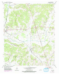
Editions of this 1951 Guys Map
3 editions found

Other maps of this area

1936 · Kendrick
USGS Topo · 1:24,000

1936 · Purdy
USGS Topo · 1:24,000

1936 · Stantonville
USGS Topo · 1:24,000

1936 · Michie
USGS Topo · 1:24,000

1949 · Purdy
USGS Topo · 1:24,000

1949 · Stantonville
USGS Topo · 1:24,000

1949 · Michie
USGS Topo · 1:24,000

1950 · Corinth
USGS Topo · 1:62,500

1950 · Kendrick
USGS Topo · 1:24,000

1951 · Chewalla
USGS Topo · 1:24,000