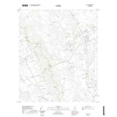
2020 Map of Guyton
USGS Topo · Published 2020About this map
The Ogeechee River meanders along the boundary between Effingham and Bulloch counties, defining the western edge of this coastal plain landscape. Small settlements and rural junctions like Guyton, Pineora, and Marlow anchor the eastern side, while family-named landmarks and historical burial grounds such as Old Providence Cem and Newton Cem are scattered across the terrain. The river is a focal point for infrastructure, featuring the Captain William Cone Bridge and Doctor Floyd Bridge, which provide essential crossings over the marshy bottomlands and Raccoon Keys.
Find a feature on this map
129 named features on this map. Tap any name to fly to it.
Don’t see what you’re looking for? This feature index may not catch every label — zoom into the map to look around manually.
Map Details
Editions of this 2020 Guyton Map
This is the sole edition of this map. No revisions or reprints were ever made.
Other maps of this area

1919 · Egypt
USGS Topo · 1:62,500

1920 · Pembroke
USGS Topo · 1:62,500

1920 · Meldrim
USGS Topo · 1:62,500

1921 · Brooklet
USGS Topo · 1:62,500

1939 · Egypt
USGS Topo · 1:62,500

1942 · Meldrim
USGS Topo · 1:62,500

1943 · Brooklet
USGS Topo · 1:62,500

1943 · Egypt
USGS Topo · 1:62,500

1947 · Savannah
USGS Topo · 1:250,000

1948 · Savannah
USGS Topo · 1:250,000