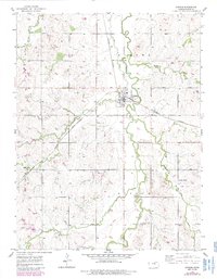
1955 Map of Gypsum
USGS Topo · Published 1985About this map
Gypsum serves as the central hub of this agricultural landscape in Saline County, where the Missouri Pacific railroad cuts a diagonal path through the township boundaries of Eureka and Gypsum. The map documents a community anchored by its rural institutions, featuring the German Temple in the southeast and a series of burial grounds including Gypsum Cem, St Patrick Cem, and Chapel Hill Cem.
Find a feature on this map
18 named features on this map. Tap any name to fly to it.
Don’t see what you’re looking for? This feature index may not catch every label — zoom into the map to look around manually.
Map Details
Editions of this 1955 Gypsum Map
3 editions found
Other maps of this area

1889 · Abilene
USGS Topo · 1:125,000

1892 · Salina
USGS Topo · 1:125,000

1894 · Abilene
USGS Topo · 1:125,000

1942 · Salina
USGS Topo · 1:125,000

1955 · Salina
USGS Topo · 1:24,000

1955 · Assaria
USGS Topo · 1:24,000

1955 · Kipp
USGS Topo · 1:24,000

1955 · Gypsum
USGS Topo · 1:24,000

1955 · Hutchinson
USGS Topo · 1:250,000

1959 · Hutchinson
USGS Topo · 1:250,000