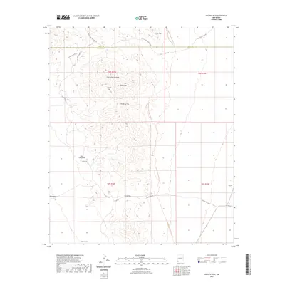
2023 Map of Hachita Peak
USGS Topo · Published 2023About this map
The Little Hatchet Mountains dominate this arid landscape along the border of Grant and Hidalgo counties. Anchored by the prominent Hachita Peak, the terrain is defined by dramatic elevation changes, including Lalacha Peak and the geological formations of Howells Ridge. This high-desert region serves as a critical corridor for travelers and wildlife, with Granite Pass and Broken Jug Pass providing natural transit points through the range.
Find a feature on this map
23 named features on this map. Tap any name to fly to it.
Don’t see what you’re looking for? This feature index may not catch every label — zoom into the map to look around manually.
Map Details
Editions of this 2023 Hachita Peak Map
This is the sole edition of this map. No revisions or reprints were ever made.
Other maps of this area

1918 · Big Hatchet Peak
USGS Topo · 1:62,500

1918 · Hachita
USGS Topo · 1:62,500

1918 · Walnut Wells
USGS Topo · 1:62,500

1918 · Playas
USGS Topo · 1:62,500

1919 · Playas
USGS Topo · 1:62,500

1923 · Walnut Wells
USGS Topo · 1:62,500

1955 · Douglas
USGS Topo · 1:250,000

1959 · Douglas
USGS Topo · 1:250,000

1961 · Douglas
USGS Topo · 1:250,000

1964 · Douglas
USGS Topo · 1:250,000