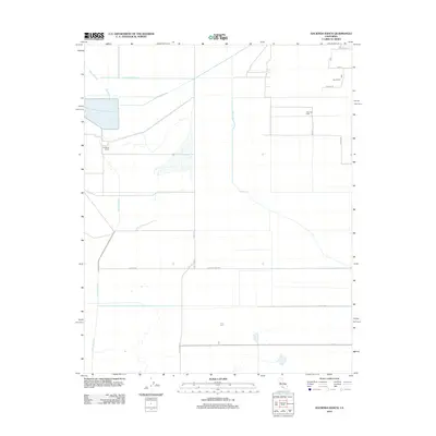
2012 Map of Hacienda Ranch
USGS Topo · Published 2012About this map
Hacienda Ranch and Bent Ranch anchor this landscape of the southern San Joaquin Valley, where the topography is defined by an extensive network of water management and energy extraction. The area's agricultural and industrial infrastructure is visible through major waterways like Homeland Canal, Poso Canal, and the Goose Lake Canal, which cut straight lines across the valley floor. To the east, the Trico Gas Field indicates the region's intersection with the energy sector. A rigid grid of regional roads, including Co Line Rd and Country Line Ave, provides the framework for navigating this rural expanse. The map also captures local hydrology features such as Bull Slough, which deviates from the engineered precision of the surrounding canals. This 2012 survey documents a corner of Kings County shaped by large-scale irrigation and natural resource development.
Find a feature on this map
18 named features on this map. Tap any name to fly to it.
Don’t see what you’re looking for? This feature index may not catch every label — zoom into the map to look around manually.
Map Details
Editions of this 2012 Hacienda Ranch Map
This is the sole edition of this map. No revisions or reprints were ever made.
Other maps of this area

1914 · Lost Hills
USGS Topo · 1:125,000

1929 · Alpaugh
USGS Topo · 1:31,680

1929 · Hacienda Ranch
USGS Topo · 1:31,680

1929 · West Alpaugh
USGS Topo · 1:31,680

1929 · Allensworth
USGS Topo · 1:31,680

1930 · Hamlin School
USGS Topo · 1:31,680

1930 · Miramonte Ranch
USGS Topo · 1:31,680

1931 · Harvester
USGS Topo · 1:31,680

1932 · Reynolds Ranch
USGS Topo · 1:31,680

1932 · Lone Tree Well
USGS Topo · 1:31,680