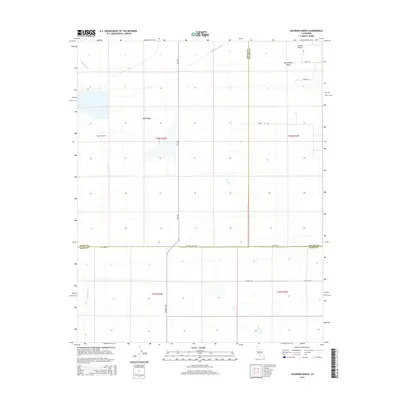
2015 Map of Hacienda Ranch
USGS Topo · Published 2015About this map
San Joaquin Valley agriculture dominates this 2015 survey, where the intersection of Kings, Kern, and Tulare counties creates a complex jurisdictional landscape. The area is defined by a grid of irrigation infrastructure including the Homeland Canal, Goose Lake Canal, and Poso Canal, which transform the arid floor of the Central Valley into productive land. Hacienda Ranch serves as a primary localized landmark amidst a vast network of section-line roads such as 6th Ave and Corcoran Rd. The topography is exceptionally level, broken only by the subtle elevation of Sand Ridge. This map captures the industrial-scale farming operations and water management systems that characterize the region's contemporary economic life, illustrating how historic land divisions like t24s r22e continue to organize the modern landscape.
Find a feature on this map
22 named features on this map. Tap any name to fly to it.
Don’t see what you’re looking for? This feature index may not catch every label — zoom into the map to look around manually.
Map Details
Editions of this 2015 Hacienda Ranch Map
This is the sole edition of this map. No revisions or reprints were ever made.
Other maps of this area

1914 · Lost Hills
USGS Topo · 1:125,000

1929 · Alpaugh
USGS Topo · 1:31,680

1929 · Hacienda Ranch
USGS Topo · 1:31,680

1929 · West Alpaugh
USGS Topo · 1:31,680

1929 · Allensworth
USGS Topo · 1:31,680

1930 · Hamlin School
USGS Topo · 1:31,680

1930 · Miramonte Ranch
USGS Topo · 1:31,680

1931 · Harvester
USGS Topo · 1:31,680

1932 · Reynolds Ranch
USGS Topo · 1:31,680

1932 · Lone Tree Well
USGS Topo · 1:31,680