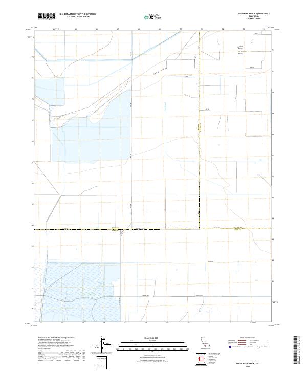
2021 Map of Hacienda Ranch
USGS Topo · Published 2021About this map
The Central Valley San Joaquin Valley landscape across the borders of Kings, Tulare, and Kern Counties is defined by an intensive network of agricultural infrastructure. A complex system of water management dominates the terrain, featuring the Homeland Canal and Poso Canal, which support the large-scale ranching and farming operations of the region. The southern portion of the map is characterized by the expansive wetlands associated with the Goose Lake Canal, providing a stark contrast to the surveyed grid of the surrounding plains. The prominence of Sand Ridge provides a subtle natural elevation amidst the flat valley floor, while a rigorous grid of section lines and roads like Garces Hwy and Co Line Rd organize the territory into the productive blocks typical of California's interior agricultural heartland.
Find a feature on this map
26 named features on this map. Tap any name to fly to it.
Don’t see what you’re looking for? This feature index may not catch every label — zoom into the map to look around manually.
Map Details
Editions of this 2021 Hacienda Ranch Map
This is the sole edition of this map. No revisions or reprints were ever made.
Other maps of this area

1914 · Lost Hills
USGS Topo · 1:125,000

1929 · Alpaugh
USGS Topo · 1:31,680

1929 · Hacienda Ranch
USGS Topo · 1:31,680

1929 · West Alpaugh
USGS Topo · 1:31,680

1929 · Allensworth
USGS Topo · 1:31,680

1930 · Hamlin School
USGS Topo · 1:31,680

1930 · Miramonte Ranch
USGS Topo · 1:31,680

1931 · Harvester
USGS Topo · 1:31,680

1932 · Reynolds Ranch
USGS Topo · 1:31,680

1932 · Lone Tree Well
USGS Topo · 1:31,680