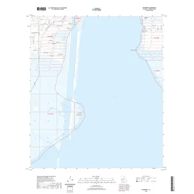
2020 Map of Hackberry
USGS Topo · Published 2020About this map
Calcasieu Lake and the engineered corridor of the Calcasieu Ship Channel dominate this coastal landscape in Cameron Parish. The settlement of Hackberry is situated on the western side of the channel, organized around Main St and W Main St. Local civic life is centered near the Post Office and the town school, while a network of residential roads like Alvin Guidry Cir and Joe Dugas Rd extend into the marshy terrain.
Find a feature on this map
37 named features on this map. Tap any name to fly to it.
Don’t see what you’re looking for? This feature index may not catch every label — zoom into the map to look around manually.
Map Details
Editions of this 2020 Hackberry Map
This is the sole edition of this map. No revisions or reprints were ever made.
Other maps of this area

1932 · Moss Lake
USGS Topo · 1:31,680

1932 · Lake Charles SW
USGS Topo · 1:31,680

1934 · Cameron
USGS Topo · 1:24,000

1934 · Holly Beach
USGS Topo · 1:24,000

1934 · Sweet Lake
USGS Topo · 1:24,000

1934 · Browns Lake
USGS Topo · 1:24,000

1934 · Grand Bayou
USGS Topo · 1:24,000

1935 · Cameron
USGS Topo · 1:31,680

1935 · Sweet Lake
USGS Topo · 1:31,680

1935 · Hackberry
USGS Topo · 1:31,680