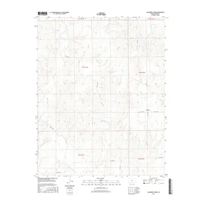
2016 Map of Hackberry Creek
USGS Topo · Published 2016About this map
Eldred occupies a central position in this survey of Barber County, where the southern plains are defined by a network of drainage systems and rural section lines. The Salt Fork Arkansas River cuts through the southwestern corner, joined by tributaries like Big Sandy Cr and the map's namesake Hackberry Creek. The landscape is organized by a grid of local roads, including Lasswell Rd and Sandy Creek Rd, which provide access to the dispersed homesteads and agricultural plots of the region. This 2016 record captures the area's persistence as a ranching and farming landscape, where even minor waterways like Driftwood Cr dictate the placement of local connectors like Driftwood Rd.
Find a feature on this map
18 named features on this map. Tap any name to fly to it.
Don’t see what you’re looking for? This feature index may not catch every label — zoom into the map to look around manually.
Map Details
Editions of this 2016 Hackberry Creek Map
This is the sole edition of this map. No revisions or reprints were ever made.
Other maps of this area

1891 · Medicine Lodge
USGS Topo · 1:125,000

1893 · Medicine Lodge
USGS Topo · 1:125,000

1955 · Woodward
USGS Topo · 1:250,000

1955 · Pratt
USGS Topo · 1:250,000

1958 · Woodward
USGS Topo · 1:250,000

1959 · Pratt
USGS Topo · 1:250,000

1969 · Tegarden NE
USGS Topo · 1:24,000

1969 · Tegarden NW
USGS Topo · 1:24,000

1969 · Alva NW
USGS Topo · 1:24,000

1973 · Hardtner NW
USGS Topo · 1:24,000