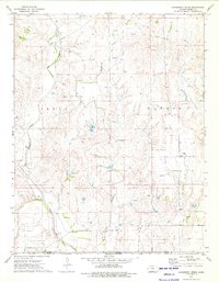
1973 Map of Hackberry Creek
USGS Topo · Published 1975About this map
Salt Fork Arkansas River winds through the southern portion of this landscape, marking a significant hydrological feature just north of the Kansas Oklahoma state line. The terrain is defined by a dense network of energy extraction infrastructure, with numerous Oil Wells and Gas Wells scattered across the Gas Field in the townships of Aetna and Elwood. This 1970s survey captures a rural industrial environment where a long-distance Pipeline traverses the hills near the settlement of Eldred. A notable historical marker on the land is the Old Indian Treaty Boundary, which cuts across the central section of the map, providing a glimpse into the earlier political and territorial organization of Barber County. The drainage patterns of Big Sandy Creek, Hackberry Creek, and Driftwood Creek reveal the deeply etched topography typical of this prairie border region.
Find a feature on this map
15 named features on this map. Tap any name to fly to it.
Don’t see what you’re looking for? This feature index may not catch every label — zoom into the map to look around manually.
Map Details
Editions of this 1973 Hackberry Creek Map
This is the sole edition of this map. No revisions or reprints were ever made.
Other maps of this area

1891 · Medicine Lodge
USGS Topo · 1:125,000

1893 · Medicine Lodge
USGS Topo · 1:125,000

1955 · Woodward
USGS Topo · 1:250,000

1955 · Pratt
USGS Topo · 1:250,000

1958 · Woodward
USGS Topo · 1:250,000

1959 · Pratt
USGS Topo · 1:250,000

1969 · Tegarden NE
USGS Topo · 1:24,000

1969 · Tegarden NW
USGS Topo · 1:24,000

1969 · Alva NW
USGS Topo · 1:24,000

1973 · Hardtner NW
USGS Topo · 1:24,000