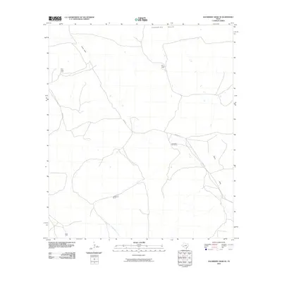
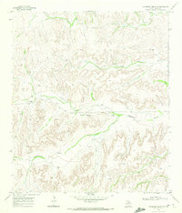
2010 Map of Hackberry Draw NE
USGS Topo · Published 2010About this map
Sherbing Mesa anchors this portion of Pecos County, where the landscape is defined by the legacy of West Texas ranching operations. The map documents several named cattle stations belonging to the Harral family, including the WW Harral Ranch, W A Harral Ranch, and the Bill and Fred Harral Ranch, reflecting the generational footprint of a single family across this desert terrain. These ranch sites are connected by a network of unimproved roads and specialized routes like Harral Rd, following natural drainage patterns. To the south, the terrain descends toward the North Fork Independence Creek, while Harral Draw carves through the northern section. This 2010 survey provides a modern layout of established private holdings such as the Montgomery Ranch and Owen Ranch in an area where water access and topographic relief dictate the placement of every homestead and corralling facility.
Find a feature on this map
9 named features on this map. Tap any name to fly to it.
Don’t see what you’re looking for? This feature index may not catch every label — zoom into the map to look around manually.
Map Details
Editions of this 2010 Hackberry Draw NE Map
This is the sole edition of this map. No revisions or reprints were ever made.
Other maps of this area

1929 · Independence Draw Quadrangle
USGS Topo · 1:125,000

1954 · Fort Stockton
USGS Topo · 1:250,000

1958 · Fort Stockton
USGS Topo · 1:250,000

1969 · Skyscraper Peak
USGS Topo · 1:24,000
1969 · Seventeen Ranch
USGS Topo · 1:24,000

1969 · Hackberry Draw NW
USGS Topo · 1:24,000

1969 · Hackberry Draw NE
USGS Topo · 1:24,000
1969 · Hackberry Draw SE
USGS Topo · 1:24,000
1969 · Hat-A Ranch
USGS Topo · 1:24,000
1969 · Hackberry Draw SW
USGS Topo · 1:24,000