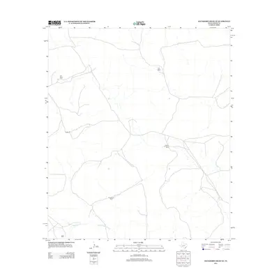
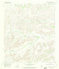
2012 Map of Hackberry Draw NE
USGS Topo · Published 2012About this map
W W Harral Ranch and W A Harral Ranch anchor the northern reaches of this high-desert landscape in Pecos County, documenting the expansive ranching operations that define this corner of West Texas. The map illustrates a network of private access roads and trails, most notably Harral Rd, which connects several significant family holdings. To the south, the terrain descends toward the drainage of N Fork Independence Cr, a vital water source for the surrounding livestock country. Additional family landholdings, including the Bill and Fred Harral Ranch, Montgomery Ranch and Owen Ranch, are meticulously positioned, offering a detailed record of land use and family history in a region where settlement is defined by the availability of water and the reach of local ranch roads.
Find a feature on this map
7 named features on this map. Tap any name to fly to it.
Don’t see what you’re looking for? This feature index may not catch every label — zoom into the map to look around manually.
Map Details
Editions of this 2012 Hackberry Draw NE Map
This is the sole edition of this map. No revisions or reprints were ever made.
Other maps of this area

1929 · Independence Draw Quadrangle
USGS Topo · 1:125,000

1954 · Fort Stockton
USGS Topo · 1:250,000

1958 · Fort Stockton
USGS Topo · 1:250,000

1969 · Skyscraper Peak
USGS Topo · 1:24,000
1969 · Seventeen Ranch
USGS Topo · 1:24,000

1969 · Hackberry Draw NW
USGS Topo · 1:24,000

1969 · Hackberry Draw NE
USGS Topo · 1:24,000
1969 · Hackberry Draw SE
USGS Topo · 1:24,000
1969 · Hat-A Ranch
USGS Topo · 1:24,000
1969 · Hackberry Draw SW
USGS Topo · 1:24,000