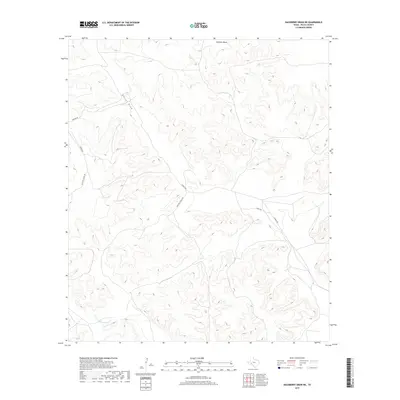
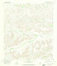
2019 Map of Hackberry Draw NE
USGS Topo · Published 2019About this map
Sherbino Mesa anchors the high ground in this arid corner of Pecos County, where the topography is defined by the deep incisions of West Texas drainage systems. The landscape is dominated by the winding course of Harral Draw as it cuts through the plateau, eventually giving way to the N Fork Independence Cr in the southern reaches. This modern survey illustrates a remote ranching environment where the movement of people is restricted to a handful of established routes including Horton Rd and Harral Rd. The road network, including the private access of Mitchell Ranch Rd and the junction of Marty Rd, provides a clear view of how large-scale landholdings are managed and accessed in this part of the Trans-Pecos. The intricate contour lines trace the complex erosion patterns that characterize the transition from mesa tops to the dry creek beds below.
Find a feature on this map
7 named features on this map. Tap any name to fly to it.
Don’t see what you’re looking for? This feature index may not catch every label — zoom into the map to look around manually.
Map Details
Editions of this 2019 Hackberry Draw NE Map
This is the sole edition of this map. No revisions or reprints were ever made.
Other maps of this area

1929 · Independence Draw Quadrangle
USGS Topo · 1:125,000

1954 · Fort Stockton
USGS Topo · 1:250,000

1958 · Fort Stockton
USGS Topo · 1:250,000

1969 · Skyscraper Peak
USGS Topo · 1:24,000
1969 · Seventeen Ranch
USGS Topo · 1:24,000

1969 · Hackberry Draw NW
USGS Topo · 1:24,000

1969 · Hackberry Draw NE
USGS Topo · 1:24,000
1969 · Hackberry Draw SE
USGS Topo · 1:24,000
1969 · Hat-A Ranch
USGS Topo · 1:24,000
1969 · Hackberry Draw SW
USGS Topo · 1:24,000