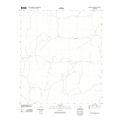
2010 Map of Hackberry Draw SW
USGS Topo · Published 2010About this map
Slaughter Ranch stands as a focal point in this portion of Pecos County, situated at the junction of several desert tracks and Gray Ranch Rd. The landscape is defined by its drainage patterns, most notably the winding course of Independence Creek which cuts through the southern half of the quadrangle. In the north, Hackberry Draw travels eastward across the arid terrain. The map's sparse settlement pattern is characteristic of this region of West Texas, where large ranching operations and natural watercourses dictate the geography of the land. It offers a clear record of the rural infrastructure and hydraulic features that supported local agriculture and transit in the early 21st century.
Find a feature on this map
4 named features on this map. Tap any name to fly to it.
Don’t see what you’re looking for? This feature index may not catch every label — zoom into the map to look around manually.
Map Details
Editions of this 2010 Hackberry Draw SW Map
This is the sole edition of this map. No revisions or reprints were ever made.
Other maps of this area

1920 · Longfellow
USGS Topo · 1:125,000

1928 · Sanderson
USGS Topo · 1:125,000

1928 · Comanche Spring
USGS Topo · 1:125,000

1929 · Independence Draw Quadrangle
USGS Topo · 1:125,000

1954 · Fort Stockton
USGS Topo · 1:250,000

1958 · Fort Stockton
USGS Topo · 1:250,000

1968 · Busher Canyon
USGS Topo · 1:24,000

1969 · Big Canyon Ranch NW
USGS Topo · 1:24,000

1969 · Hackberry Draw NW
USGS Topo · 1:24,000

1969 · Hackberry Draw NE
USGS Topo · 1:24,000