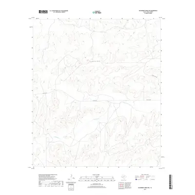
2019 Map of Hackberry Draw SW
USGS Topo · Published 2019About this map
Independence Cr and Hackberry Draw carve through this section of Pecos County, defining a landscape shaped by intermittent watercourses and sprawling ranch lands. In this late 2010s survey, the infrastructure of the West Texas interior is represented by primitive road networks serving isolated outposts. Long-established ranching interests are evident through the presence of Gray Ranch Rd and Huckaby Ranch Rd, which provide the primary access through the undulating terrain. The drainage patterns of the draws and creeks illustrated here are essential to understanding the historic land use and pastoral economy of this semi-arid region, where water sources dictated the placement of trails and early settlements.
Find a feature on this map
4 named features on this map. Tap any name to fly to it.
Don’t see what you’re looking for? This feature index may not catch every label — zoom into the map to look around manually.
Map Details
Editions of this 2019 Hackberry Draw SW Map
This is the sole edition of this map. No revisions or reprints were ever made.
Other maps of this area

1920 · Longfellow
USGS Topo · 1:125,000

1928 · Sanderson
USGS Topo · 1:125,000

1928 · Comanche Spring
USGS Topo · 1:125,000

1929 · Independence Draw Quadrangle
USGS Topo · 1:125,000

1954 · Fort Stockton
USGS Topo · 1:250,000

1958 · Fort Stockton
USGS Topo · 1:250,000

1968 · Busher Canyon
USGS Topo · 1:24,000

1969 · Big Canyon Ranch NW
USGS Topo · 1:24,000

1969 · Hackberry Draw NW
USGS Topo · 1:24,000

1969 · Hackberry Draw NE
USGS Topo · 1:24,000