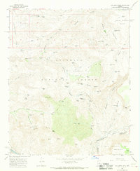
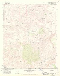
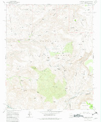
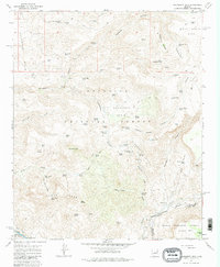
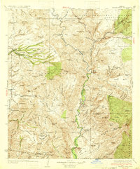
1967 Map of Hackberry Mtn.
USGS Topo · Published 1968About this map
The Cimarron Hills and Towel Peaks dominate this high-desert landscape in central Arizona, captured here in a 1965 survey. This area within the Tonto National Forest and Coconino National Forest shows a sophisticated system of water management essential for ranching and survival in the arid high country. Dozens of named catchment tanks, such as Nine and a Half Mile Tank and Sycamore Tank, are scattered across the basins and mesas, illustrating the reliance on seasonal runoff.
Find a feature on this map
78 named features on this map. Tap any name to fly to it.
Don’t see what you’re looking for? This feature index may not catch every label — zoom into the map to look around manually.
Map Details
Editions of this 1967 Hackberry Mtn. Map
4 editions found
Other maps of this area

1887 · Verde
USGS Topo · 1:250,000

1892 · Verde
USGS Topo · 1:250,000

1923 · Camp Verde
USGS Topo · 1:125,000

1929 · Turret Peak
USGS Topo · 1:125,000

1932 · Camp Verde
USGS Topo · 1:125,000
1933 · Turret Peak
USGS Topo · 1:125,000
1936 · Camp Verde
USGS Topo · 1:125,000

1954 · Holbrook
USGS Topo · 1:250,000

1957 · Holbrook
USGS Topo · 1:250,000

1958 · Holbrook
USGS Topo · 1:250,000