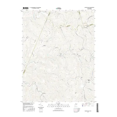
2016 Map of Hacker Valley
USGS Topo · Published 2016About this map
Hacker Valley and the surrounding highlands of Central West Virginia are defined by the winding course of the Little Kanawha River and the Left Fork Holly River. This 2016 survey illustrates the intricate network of county roads and mountain ridges that separate isolated settlements like Guardian, Replete, and Vernon. The topography is marked by significant landmarks such as Courthouse Rock and Hanging Rock, while the Groves and Anderson Memorial Bridge provides a vital crossing near Cleveland. Genealogists will find a wealth of local data in the distribution of family-named cemeteries, including the Hall Cem, Alfred Anderson Cem, and Chestnut Grove Cem. The map effectively shows the interplay between the steep terrain of Hodam Mtn and the narrow valley floors where small communities have persisted along runs like Hodam Cr and Jerry Run.
Find a feature on this map
95 named features on this map. Tap any name to fly to it.
Don’t see what you’re looking for? This feature index may not catch every label — zoom into the map to look around manually.
Map Details
Editions of this 2016 Hacker Valley Map
This is the sole edition of this map. No revisions or reprints were ever made.
Other maps of this area

1893 · Buckhannon
USGS Topo · 1:125,000

1893 · Sutton
USGS Topo · 1:125,000

1896 · Buckhannon
USGS Topo · 1:125,000

1897 · Buckhannon
USGS Topo · 1:125,000

1906 · Burnsville
USGS Topo · 1:62,500

1908 · Sutton
USGS Topo · 1:48,000

1910 · Sutton Special
USGS Topo · 1:62,500

1912 · Crawford
USGS Topo · 1:48,000

1913 · Hacker Valley
USGS Topo · 1:48,000

1914 · Crawford
USGS Topo · 1:62,500