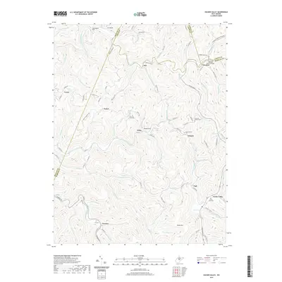
2019 Map of Hacker Valley
USGS Topo · Published 2019About this map
Hacker Valley and the surrounding high country of the Allegheny Plateau are defined by the convergence of several major water systems, including the Little Kanawha River and the Right Fork Holly River. This 2019 survey captures a landscape of dispersed mountain settlements and family-named landmarks that speak to the region's deep-rooted genealogy. Small communities like Cleveland, Vernon, and Guardian are linked by winding roads such as Replete Rd and Cleveland Rd, while the topography is punctuated by prominent features like Hanging Rock and Hodam Mtn.
Find a feature on this map
95 named features on this map. Tap any name to fly to it.
Don’t see what you’re looking for? This feature index may not catch every label — zoom into the map to look around manually.
Map Details
Editions of this 2019 Hacker Valley Map
This is the sole edition of this map. No revisions or reprints were ever made.
Other maps of this area

1893 · Buckhannon
USGS Topo · 1:125,000

1893 · Sutton
USGS Topo · 1:125,000

1896 · Buckhannon
USGS Topo · 1:125,000

1897 · Buckhannon
USGS Topo · 1:125,000

1906 · Burnsville
USGS Topo · 1:62,500

1908 · Sutton
USGS Topo · 1:48,000

1910 · Sutton Special
USGS Topo · 1:62,500

1912 · Crawford
USGS Topo · 1:48,000

1913 · Hacker Valley
USGS Topo · 1:48,000

1914 · Crawford
USGS Topo · 1:62,500