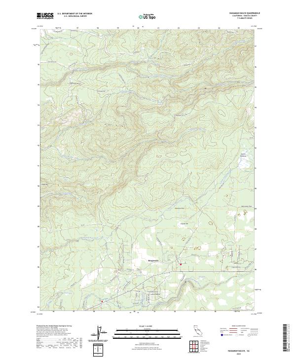
2023 Map of Hagaman Gulch
USGS Topo · Published 2023About this map
Shingletown serves as the primary residential hub in this 2023 survey of Shasta County, situated at the intersection of modern road networks and the historic Emigrant Trl. The landscape is defined by its dramatic drainage systems, including Hagaman Gulch and Miners Gulch, which cut through a series of high-elevation plateaus. Distinctive terrain features like Chalk Mtn and expansive level ground such as Poorman Flat and McCumber Flat illustrate the varied topography of this timber-rich region.
Find a feature on this map
70 named features on this map. Tap any name to fly to it.
Don’t see what you’re looking for? This feature index may not catch every label — zoom into the map to look around manually.
Map Details
Editions of this 2023 Hagaman Gulch Map
This is the sole edition of this map. No revisions or reprints were ever made.
Other maps of this area

1886 · Lassen Peak
USGS Topo · 1:250,000

1892 · Lassen Peak
USGS Topo · 1:250,000

1894 · Lassen Peak
USGS Topo · 1:250,000

1935 · Burney
USGS Topo · 1:96,000

1935 · Paynes Creek
USGS Topo · 1:96,000

1939 · Burney
USGS Topo · 1:125,000

1941 · Mineral
USGS Topo · 1:125,000

1955 · Westwood
USGS Topo · 1:250,000

1956 · Lassen Peak
USGS Topo · 1:62,500

1956 · Manton
USGS Topo · 1:62,500