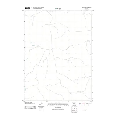
2011 Map of Hagan Lake
USGS Topo · Published 2011About this map
Hagan Lake is the defining geographic landmark within this sparsely populated stretch of the Nebraska Sandhills. This 2011 survey by the U.S. Geological Survey reveals a landscape dominated by internal drainage and high-desert hydrology, where seasonal wetlands and small basins dot the terrain. The map illustrates a network of local roads and unimproved trails that navigate the undulating contours characteristic of Rock County. This specific era of mapping by the U.S. Geological Survey provides an essential record of the region's hydrography and land use before subsequent shifts in agricultural technology or climate patterns might further alter the ephemeral water bodies that sustain the local ecology.
Find a feature on this map
1 named feature on this map. Tap any name to fly to it.
Don’t see what you’re looking for? This feature index may not catch every label — zoom into the map to look around manually.
Map Details
Editions of this 2011 Hagan Lake Map
This is the sole edition of this map. No revisions or reprints were ever made.
Other maps of this area

1955 · O'Neill
USGS Topo · 1:250,000

1959 · O'Neill
USGS Topo · 1:250,000

1969 · O'Neill
USGS Topo · 1:250,000

1981 · Paramount Valley
USGS Topo · 1:24,000

1981 · Rose
USGS Topo · 1:24,000

1982 · Hagan Lake NE
USGS Topo · 1:24,000

1982 · Hofeld Lake
USGS Topo · 1:24,000

1982 · Raven
USGS Topo · 1:24,000
1982 · Goldman Lake NE
USGS Topo · 1:24,000
1982 · Lake George
USGS Topo · 1:24,000