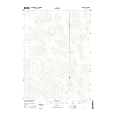
2014 Map of Hagan Lake
USGS Topo · Published 2014About this map
The Nebraska Sandhills define this landscape along the boundary of Brown Co Rock Co during the early 21st century. The terrain is characterized by a dense network of dunes and depressions, typical of this prairie region's unique geology. Hagan Lake is the primary hydrologic feature, situated amidst the complex topography of the western portion of the quadrangle. A few secondary roads and light-duty paths cross the area, reflecting the sparse settlement and agricultural nature of this part of northern Nebraska. This survey provides a clear view of the natural drainage patterns and landforms before more modern developments or shifts in land use altered the local geography.
Find a feature on this map
2 named features on this map. Tap any name to fly to it.
Don’t see what you’re looking for? This feature index may not catch every label — zoom into the map to look around manually.
Map Details
Editions of this 2014 Hagan Lake Map
This is the sole edition of this map. No revisions or reprints were ever made.
Other maps of this area

1955 · O'Neill
USGS Topo · 1:250,000

1959 · O'Neill
USGS Topo · 1:250,000

1969 · O'Neill
USGS Topo · 1:250,000

1981 · Paramount Valley
USGS Topo · 1:24,000

1981 · Rose
USGS Topo · 1:24,000

1982 · Hagan Lake NE
USGS Topo · 1:24,000

1982 · Hofeld Lake
USGS Topo · 1:24,000

1982 · Raven
USGS Topo · 1:24,000
1982 · Goldman Lake NE
USGS Topo · 1:24,000
1982 · Lake George
USGS Topo · 1:24,000