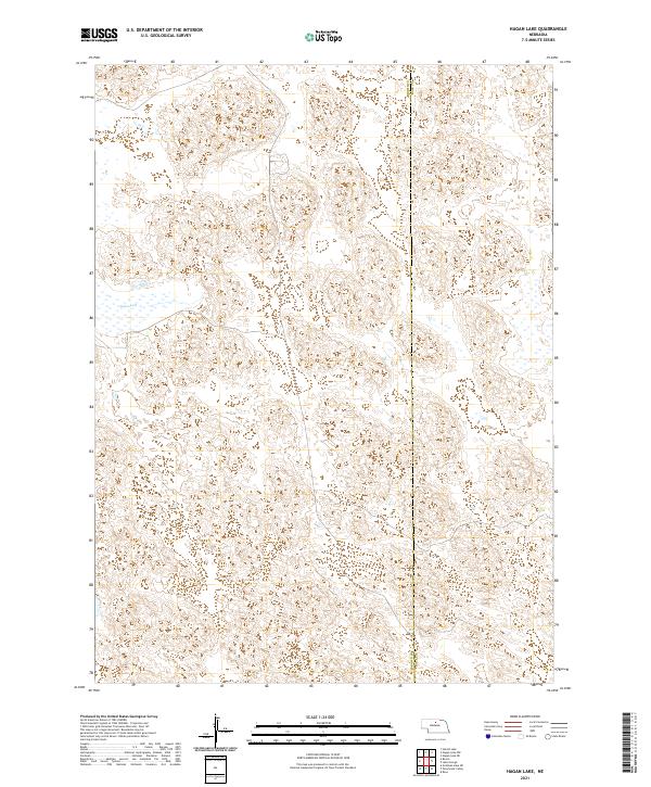
2021 Map of Hagan Lake
USGS Topo · Published 2021About this map
Hagan Lake sits as the primary landmark in this remote corner of the Nebraska Sandhills during the early twenty-first century. The landscape is defined by its complex dune topography and internal drainage basins, characteristic of the state's expansive prairie regions. This survey follows the north-south boundary between Brown Co and Rock Co, cutting through a nearly unpopulated area where the terrain remains largely undisturbed by modern development or dense road networks. The map provides a detailed view of the natural wetland depressions and the intricate contour patterns of the surrounding hills, illustrating the geographic isolation and physical character of this portion of north-central Nebraska.
Find a feature on this map
8 named features on this map. Tap any name to fly to it.
Don’t see what you’re looking for? This feature index may not catch every label — zoom into the map to look around manually.
Map Details
Editions of this 2021 Hagan Lake Map
This is the sole edition of this map. No revisions or reprints were ever made.
Other maps of this area

1955 · O'Neill
USGS Topo · 1:250,000

1959 · O'Neill
USGS Topo · 1:250,000

1969 · O'Neill
USGS Topo · 1:250,000

1981 · Paramount Valley
USGS Topo · 1:24,000

1981 · Rose
USGS Topo · 1:24,000

1982 · Hagan Lake NE
USGS Topo · 1:24,000

1982 · Hofeld Lake
USGS Topo · 1:24,000

1982 · Raven
USGS Topo · 1:24,000
1982 · Goldman Lake NE
USGS Topo · 1:24,000
1982 · Lake George
USGS Topo · 1:24,000