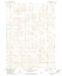
1982 Map of Hagan Lake
USGS Topo · Published 1982About this map
Hagan Lake and the undulating terrain of the Nebraska Sandhills are the primary focus of this early 1980s landscape study. The map documents a sparsely populated ranching region straddling the boundary between Brown Co and Rock Co. Large-scale agricultural operations are the dominant human footprint, represented by the Herrmann-Copple Ranch and the Assarsson Ranch. A notable Claypit and several isolated Well sites scattered across the sections indicate the importance of localized resource extraction and groundwater management in this arid environment. The presence of numerous small, unnamed basins and depressions suggests a complex hydrological system typical of this section of the state, where life centered around reliable water sources and established homesteads.
Find a feature on this map
6 named features on this map. Tap any name to fly to it.
Don’t see what you’re looking for? This feature index may not catch every label — zoom into the map to look around manually.
Map Details
Editions of this 1982 Hagan Lake Map
This is the sole edition of this map. No revisions or reprints were ever made.
Other maps of this area

1955 · O'Neill
USGS Topo · 1:250,000

1959 · O'Neill
USGS Topo · 1:250,000

1969 · O'Neill
USGS Topo · 1:250,000

1981 · Paramount Valley
USGS Topo · 1:24,000

1981 · Rose
USGS Topo · 1:24,000

1982 · Hagan Lake NE
USGS Topo · 1:24,000

1982 · Hofeld Lake
USGS Topo · 1:24,000

1982 · Raven
USGS Topo · 1:24,000
1982 · Goldman Lake NE
USGS Topo · 1:24,000
1982 · Lake George
USGS Topo · 1:24,000