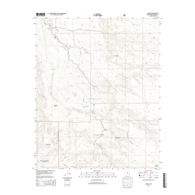
2013 Map of Hagan
USGS Topo · Published 2013About this map
Arroyo Tonque and the San Pedro Creek drainage systems define this high-desert landscape in Sandoval County, illustrating a complex network of seasonal watercourses and springs. The settlement at Hagan serves as a central point in a region characterized by deep canyons and scattered ranches, including the Diamond Tail Ranch and the community of Una de Gato. The western portion of the map transitions into the protected lands of the Cibola National Forest, where the topography steepens into Gonzales Canyon. Genealogists and local historians can find site-specific details such as the Tejon Cem and remote outposts like Cañon Tejón. The map also traces historical transit corridors along La Madera Rd and Puertocito Rd, which connect the isolated settlements of Puertecito and Cañon del Agua across the arid terrain.
Find a feature on this map
29 named features on this map. Tap any name to fly to it.
Don’t see what you’re looking for? This feature index may not catch every label — zoom into the map to look around manually.
Map Details
Editions of this 2013 Hagan Map
This is the sole edition of this map. No revisions or reprints were ever made.
Other maps of this area

1892 · San Pedro
USGS Topo · 1:125,000

1954 · Sandia Crest
USGS Topo · 1:24,000

1954 · San Felipe Pueblo
USGS Topo · 1:24,000

1954 · Placitas
USGS Topo · 1:24,000

1954 · Sandia Park
USGS Topo · 1:24,000

1954 · San Pedro
USGS Topo · 1:24,000

1954 · San Felipe Pueblo NE
USGS Topo · 1:24,000

1954 · Hagan
USGS Topo · 1:24,000

1954 · San Felipe Pueblo
USGS Topo · 1:62,500

1956 · Edgewood
USGS Topo · 1:62,500