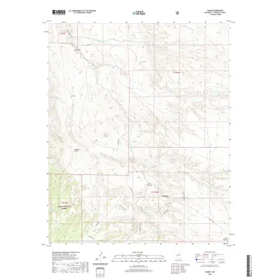
2020 Map of Hagan
USGS Topo · Published 2020About this map
Puertecito serves as a focal point in this high-desert landscape of Sandoval County, where a network of ephemeral watercourses and canyons defines the settlement pattern. The terrain is deeply etched by significant drainage systems such as Arroyo Tonque and Arroyo Coyote, which converge and wind toward the northwest. Historical land use is evident in the presence of Tejon Cem near Cañon Tejon, and the preservation of natural lands within the Cibola National Forest and the Golden Open Space. These protected areas stand alongside remote outposts and local routes like La Madera Rd and Puertocto Rd. Named water sources like San Francisco Spring and Escondido Spring highlight the critical role of water in this arid region, providing a detailed look at the geography of the southwestern edge of the Sangre de Cristo foothills.
Find a feature on this map
30 named features on this map. Tap any name to fly to it.
Don’t see what you’re looking for? This feature index may not catch every label — zoom into the map to look around manually.
Map Details
Editions of this 2020 Hagan Map
This is the sole edition of this map. No revisions or reprints were ever made.
Other maps of this area

1892 · San Pedro
USGS Topo · 1:125,000

1954 · Sandia Crest
USGS Topo · 1:24,000

1954 · San Felipe Pueblo
USGS Topo · 1:24,000

1954 · Placitas
USGS Topo · 1:24,000

1954 · Sandia Park
USGS Topo · 1:24,000

1954 · San Pedro
USGS Topo · 1:24,000

1954 · San Felipe Pueblo NE
USGS Topo · 1:24,000

1954 · Hagan
USGS Topo · 1:24,000

1954 · San Felipe Pueblo
USGS Topo · 1:62,500

1956 · Edgewood
USGS Topo · 1:62,500