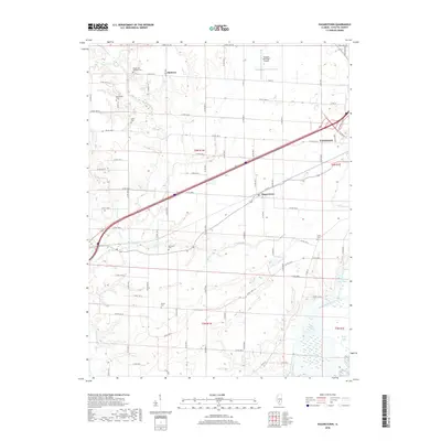
2018 Map of Hagarstown
USGS Topo · Published 2018About this map
Hagarstown sits as a central junction in Fayette County, where the transition from agricultural prairie to wooded creek bottoms defines the landscape. The western edge of Vandalia appears in the northeast, anchored by the Vandalia Municipal Airport and the intersection of modern bypasses. A dense network of county roads, such as Co RD 1550 N and Thrill Hill Rd, grids the territory, revealing a long history of rural settlement. Genealogists will find a significant concentration of family burial grounds scattered across the townships, including the Wright and Neathery Cem, McInturff Cem, and Daniel Cem. The hydrology is dominated by the winding paths of Hurricane Creek and Raccoon Cr, which eventually give way to lowlands near Fish Lake and Brush Lake in the southeast.
Find a feature on this map
54 named features on this map. Tap any name to fly to it.
Don’t see what you’re looking for? This feature index may not catch every label — zoom into the map to look around manually.
Map Details
Editions of this 2018 Hagarstown Map
This is the sole edition of this map. No revisions or reprints were ever made.
Other maps of this area

1932 · Greenville
USGS Topo · 1:62,500

1939 · Greenville
USGS Topo · 1:62,500

1943 · Greenville
USGS Topo · 1:62,500

1944 · Ramsey
USGS Topo · 1:62,500

1945 · Vandalia
USGS Topo · 1:62,500

1946 · Ramsey
USGS Topo · 1:62,500

1947 · Vandalia
USGS Topo · 1:62,500

1947 · Hillsboro
USGS Topo · 1:62,500

1949 · Hillsboro
USGS Topo · 1:62,500

1958 · Decatur
USGS Topo · 1:250,000