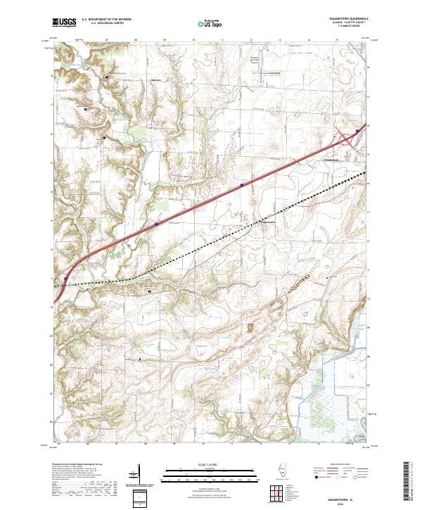
2024 Map of Hagarstown
USGS Topo · Published 2024About this map
Hagarstown and the surrounding Fayette County landscape are defined by the winding drainages of Hurricane Creek and Raccoon Creek, which carve through the agricultural tablelands west of the Kaskaskia River valley. This 2024 survey captures the rural character of the region, where legacy homesteads are marked by a significant concentration of small family and community burial grounds, including the Wright and Neathery Cem, Mcinturff Cem, and Daniel Cem. The modern infrastructure of Vandalia is visible in the northeast, where the Vandalia Municipal Airport and the intersection of W Veterans Pkwy meet the open countryside. Southward, the terrain transitions toward the bottomlands near Pecan Island, where the Fish Lake Ditch and Suttons Pond indicate a history of water management for the fertile soils of the Illinois prairie.
Find a feature on this map
76 named features on this map. Tap any name to fly to it.
Don’t see what you’re looking for? This feature index may not catch every label — zoom into the map to look around manually.
Map Details
Editions of this 2024 Hagarstown Map
This is the sole edition of this map. No revisions or reprints were ever made.
Other maps of this area

1932 · Greenville
USGS Topo · 1:62,500

1939 · Greenville
USGS Topo · 1:62,500

1943 · Greenville
USGS Topo · 1:62,500

1944 · Ramsey
USGS Topo · 1:62,500

1945 · Vandalia
USGS Topo · 1:62,500

1946 · Ramsey
USGS Topo · 1:62,500

1947 · Vandalia
USGS Topo · 1:62,500

1947 · Hillsboro
USGS Topo · 1:62,500

1949 · Hillsboro
USGS Topo · 1:62,500

1958 · Decatur
USGS Topo · 1:250,000