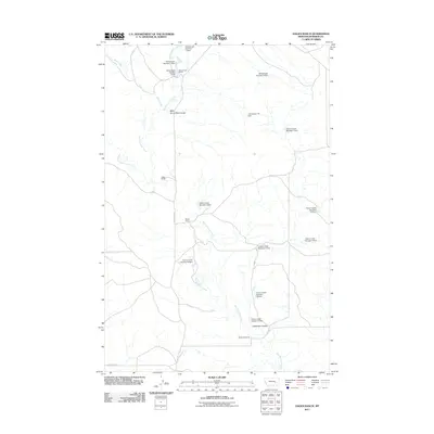
2011 Map of Hagen Ranch
USGS Topo · Published 2011About this map
Big Porcupine Creek meanders through this portion of Rosebud County, Montana, carving a complex drainage network into the landscape. Named ranching homesteads such as Schlesinger Ranch, Hagen Ranch, Mysse Ranch, and McDonald Ranch dot the map, indicating the area's continued reliance on livestock and rural land management. The terrain is defined by dry-land features like Horse Pete Coulee and Hallanger Coulee, which channel seasonal water toward the larger creek systems.
Find a feature on this map
25 named features on this map. Tap any name to fly to it.
Don’t see what you’re looking for? This feature index may not catch every label — zoom into the map to look around manually.
Map Details
Editions of this 2011 Hagen Ranch Map
This is the sole edition of this map. No revisions or reprints were ever made.
Other maps of this area

1954 · Forsyth
USGS Topo · 1:250,000

1957 · Forsyth
USGS Topo · 1:250,000

1958 · Forsyth
USGS Topo · 1:250,000

1960 · Hagen Ranch
USGS Topo · 1:24,000

1960 · Thebes
USGS Topo · 1:24,000

1960 · Ingomar East
USGS Topo · 1:24,000

1960 · Brown Coulee
USGS Topo · 1:24,000

1960 · Zempel Lake
USGS Topo · 1:24,000

1960 · Black Sea Reservoir
USGS Topo · 1:24,000

1965 · Acorn Flats
USGS Topo · 1:24,000