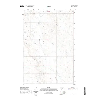
2020 Map of Hagen Ranch
USGS Topo · Published 2020About this map
Hagen Ranch serves as the central landmark for this portion of Rosebud County, situated within a vast drainage network dominated by Big Porcupine Cr. The landscape is defined by its deep coulees and intermittent watercourses, illustrating the traditional ranching geography of eastern Montana. Named terrain features like Wild Horse Pete Coulee and Hallanger Coulee provide specific points of reference for local historians tracing land use and topography. The area is accessed via a sparse network of rural roads, including Acorn Flats Rd and Cohagen Rd, which follow the natural contours of the high plains. Minor tributaries such as McGinnis Cr and Short Cr feed into the larger creek systems, marking the drainage patterns of this rural ranching district.
Find a feature on this map
12 named features on this map. Tap any name to fly to it.
Don’t see what you’re looking for? This feature index may not catch every label — zoom into the map to look around manually.
Map Details
Editions of this 2020 Hagen Ranch Map
This is the sole edition of this map. No revisions or reprints were ever made.
Other maps of this area

1954 · Forsyth
USGS Topo · 1:250,000

1957 · Forsyth
USGS Topo · 1:250,000

1958 · Forsyth
USGS Topo · 1:250,000

1960 · Hagen Ranch
USGS Topo · 1:24,000

1960 · Thebes
USGS Topo · 1:24,000

1960 · Ingomar East
USGS Topo · 1:24,000

1960 · Brown Coulee
USGS Topo · 1:24,000

1960 · Zempel Lake
USGS Topo · 1:24,000

1960 · Black Sea Reservoir
USGS Topo · 1:24,000

1965 · Acorn Flats
USGS Topo · 1:24,000