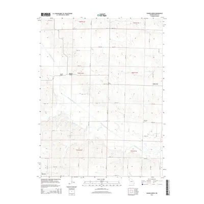
2014 Map of Hagers Grove
USGS Topo · Published 2014About this map
The North Fork Salt River meanders across this rural section of Shelby County, anchoring a landscape defined by small watercourses like Bear Cr and Pollard Br. The small settlement of Hagers Grove sits near the Snowder Bridges, while the eastern portion of the map shows the hamlet of Kellerville. This 2014 survey reveals a persistent rural grid system of county roads, such as Shelby 210 and Shelby 316, connecting isolated family farms and local history landmarks. Genealogists and local historians can locate long-established burial grounds including Morris Cemetery and Mount Hope Cemetery, which serve as quiet markers of the community's heritage amidst the agricultural fields and drainage basins of Ten Mile Cr and Sink Br.
Find a feature on this map
59 named features on this map. Tap any name to fly to it.
Don’t see what you’re looking for? This feature index may not catch every label — zoom into the map to look around manually.
Map Details
Editions of this 2014 Hagers Grove Map
This is the sole edition of this map. No revisions or reprints were ever made.
Other maps of this area

1908 · Atlanta
USGS Topo · 1:62,500

1908 · Macon
USGS Topo · 1:62,500

1910 · Macon
USGS Topo · 1:62,500

1953 · Moberly
USGS Topo · 1:250,000

1954 · Moberly
USGS Topo · 1:250,000

1957 · Moberly
USGS Topo · 1:250,000

1958 · Lentner
USGS Topo · 1:24,000

1959 · Shelbina
USGS Topo · 1:24,000

1960 · Moberly
USGS Topo · 1:250,000
1963 · Leonard
USGS Topo · 1:24,000