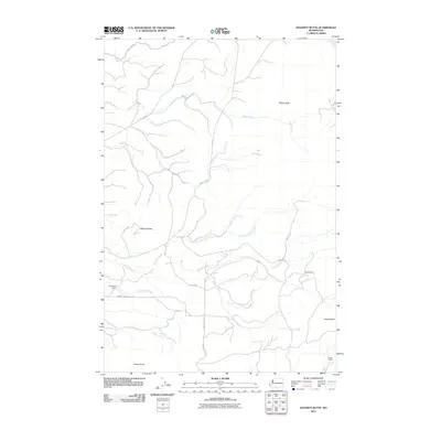
2011 Map of Hagerty Butte
USGS Topo · Published 2011About this map
Hagerty Butte and Sheep Butte rise above a landscape defined by an intricate network of waterways and Bureau of Indian Affairs access roads in this 2011 survey of Yakima County. The terrain is deeply carved by drainage systems including Twentyfive Mile Creek, Summit Creek, and Blue Creek, which flow through the high country. Human presence is marked by established outposts such as Featherbed Camp, Yeackel Camp, and Garner Camp, likely serving as seasonal or operational hubs within the Yakima Indian Reservation. These camps, connected by routes like Summit Creek Rd and Kaiser Butte Rd, reflect the managed use of the land for forestry or grazing. The map also traces the path of White Fir Creek along the eastern margin, highlighting the topographical prominence of landmarks like Potato Butte and Kaiser Butte in the southern reaches of the quadrangle.
Find a feature on this map
25 named features on this map. Tap any name to fly to it.
Don’t see what you’re looking for? This feature index may not catch every label — zoom into the map to look around manually.
Map Details
Editions of this 2011 Hagerty Butte Map
This is the sole edition of this map. No revisions or reprints were ever made.
Other maps of this area

1904 · Mount Adams
USGS Topo · 1:125,000

1907 · Mount Adams
USGS Topo · 1:125,000

1934 · The Dalles
USGS Topo · 1:125,000

1937 · White Swan
USGS Topo · 1:125,000

1950 · Yakima
USGS Topo · 1:250,000

1953 · The Dalles
USGS Topo · 1:250,000

1956 · The Dalles
USGS Topo · 1:250,000

1957 · The Dalles
USGS Topo · 1:250,000

1957 · Klickitat
USGS Topo · 1:62,500

1957 · Goldendale
USGS Topo · 1:62,500